|
©The Archaeological Settlements of Turkey - TAY Project
|
|
|
|
|
|
Gözlükule |
|
|
For site maps and drawings please click on the picture... 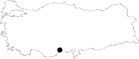 |
For photographs please click on the photo... 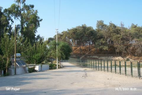 |
|
Type:
|
Mound |
|
Altitude:
|
150 m |
|
Region:
|
Mediterranean |
|
Province:
|
Mersin |
|
District:
|
Tarsus |
|
Village:
|
Merkez |
|
Investigation Method:
|
Excavation |
|
Period:
|
EBA III EBA II EBA I |
|
|
|
 |
|
| Location: The site lies in Gözlükule Quarter; southwest of Tarsus District northeast of Içel Province. The mound is known as "Tarsus" in some archaeological publications. |
| Geography and Environment: Flat and conical mound is 25 m long; and has a diameter of 300 m. Modern settlements surround the site; today. Tarsus Stream passes by the eastern side. The settlement is thought to be located very close to the sea during the first settlement. |
| History: |
| Research and Excavation: The excavations carried out in Gözlükule can be grouped into two as before and after the World War II. The 1934 and 1936-37 excavations were conducted before the World War II. Following the war; it was re-excavated by H. Goldman of the College of Bryn Mawr in the name of the American-Tarsus exploration team in 1947-1949. The Chalcolithic Age levels were revealed in a 3.5x4.5 m trench [Goldman 1956:fig.1; 2]. The water table prevented the excavators to reach the virgin soil. Late Chalcolithic Age graves were revealed in the trenches on the southeastern slope of the mound and in the plain; below it [Goldman 1956:6-7]. In September 2000; a team from the Bogaziçi University; Faculty of Science-Letters; History Department made some preliminary preparations with M.J. Mellink who is also a member of the old excavation team. In 2000; researches were started in Gözlükule and the region. Studies are being continued. Excavations were resumed by Bosphorus University in 2007 under A. Özyar. It takes place in the registered archaeological sites list prepared by Ministry of Culture and Tourism. |
| Stratigraphy: The surface collection and the excavation have laid out that the site had been continuously inhabited from the Neolithic Age to the Classical Period. The major role Gözlükule played in the Anatolian archaeology is that the cultural phases of Northern Mesopotamia were applied to the Anatolian archaeology through this settlement. The EBA period was subdivided into the phases I; II and III as a result of the Gözlükule excavations. The stratification is executed on the basis of those phases and coding. Other than the Neolithic and Chalcolithic Ages [see Harmankaya et al.1997 and 1998:Gözlükule]; building levels of the EBA I-III; the MBA; the LBA I-II; the Iron Age; the Hellenistic and Roman Periods were identified [Goldman 1956:table at 64]. |
| Small Finds: Architecture (ascending order): EBA I (between 27-20 m): Trench A on the south of the mound yielded the stone foundations of collapsed buildings. The remains were identified as fortification walls. The stone remains extend in the northeast- southwest direction. A pile of stones identified as tower; a thick pisé/mudbrick wall across it and a road between these two structures were uncovered. The entrance is approached by a stone paved road [Goldman 1956:plan 1b]. The road was renewed in the following levels. Other buildings are lined on both sides of the road. No stone foundations were found in some of the walls [Goldman 1956:plan 2-3]. Traces of floors are observed. A hearth with a mudbrick elevation on both sides is considered as a cult hearth. The settlement plan couldn't be figured out due to the insufficiency of the area excavated. The interpretations go beyond actuality depending on such restricted evidences. EBA II (between 20-11.5 m): Several building levels are observed inside the ca. 8.5 m thick cultural deposit. Moulded mudbricks are introduced. The lowest level of this phase yielded regular multi-roomed; four-cornered houses on both sides of a street [Goldman 1956:14-20; plan 4]. There are side alleys. The small projections on the inner surface of the mudbrick walls are to support the timber on the ceiling. The floors are of compressed clay; and the rooms are entered from small doors. The upper level yielded an architecture surrounded by two-storey fortification walls. The walls are thinner in the first level while in the upper level they were built thicker and saw-like. The inhabitants of this urbanized level destroyed the houses and hastily built a mudbrick wall parallel to the city walls in order to prevent the enemy penetrating into the town during an attack. The space between the two walls was utilized as shops. The thickness of the saw-like walls exceeds 2.5 m [Goldman 1956:plan 6]. The mudbricks of the wall are colored; and coated with a strewed plaster. Behind it; a thin wall was discovered. It has an "L" door and is protected by a projection; probably a tower. Behind this wall; there are houses. They are rectangular; and they don't have a regular plan. The other building level [Goldman 1956:plan 7] yielded a gate-room and a separate tower room at the city walls. In the upper level; the wall lost its features like fortification walls; and was used for some other functions with additions [Goldman 1956:plan 8-9]. Probably a new fortification was built enclosing a larger area due to the increase in the population. The structure inside the fortification wall changed accordingly; several building levels are observed in a multi-roomed structure. The walls are of mudbrick. Next to the street; a four-cornered neatly built architecture is observed. EBA III (between 11.5-9 m): No significant change is observed in the constructions and plans. Semi-circular hearths are introduced. It has multi-building levels as the other phases of EBA. In the first levels; a megaron-like structure is observed. In front; there is an entrance corridor; followed by a big room in the rear. In the upper building levels; adjacent multi-roomed structures; called eastern style; re-appear. The central room is surrounded with small rooms. Inside the rooms; there are kilns and hearths. They are built of mudbrick on a stone socle or mantel base. The rooms are in rectangular forms. The excavators suggest that this change is a result of the arrival of new communities in Tarsus. Intermediate Period (from EBA to MBA): The latest building level of EBA had been collapsed by an outer destruction. An inadequate and scattered settlement is observed. It is claimed that the former inhabitants didn't unite with the new comers. Pottery: The pottery industry of EBA was examined in detail. EBA I: Samples of the slightly washed straw-faced ware; the light colored ware; the thin spiral band decorated ware; the plain red and grit tempered ware; the red colored sand tempered pithos ware; the red colored grit and the sand tempered ware; the plain black burnished ware; the black burnished and white filling decorated ware; the plain red burnished ware; the red burnished incision decorated ware and the kitchen ware were recovered. During the interdisciplinary project conducted by A. Özyar; G. Danisman; H. Karabulut and H. Özener; the excavations on the southeastern slope of the mound; in the section of the area no. 05; the comparison of the pottery recovered from this section with the other examples of the site have have proven that the buildings can also be dated to the EBA II. The pale colored; little sand-tempered wheel-made round bowls; which are the most typical examples of Tarsus EBA; are also present here. The examples of the same bowl type with red clay and dating to the end of the EBA have also been recovered. The other finds include a sherd of a hand-made large mug or a bowl made of red clay; sherds of spouted pitchers of red clay and the rim fragment of a large pithos which was also encountered during the Goldman excavations. During the interdisciplinary work performed by A. Özyar and G. Danisman in 2005 particularly the beverage vessels were identified among the EBA III, Goldman Period material and the depas and bell shaped ones with double handles were researched [Özyar-Danisman 2009:386-387]. The same researches also continued in 2006, 40 more specimens were identified [Özyar-Danisman 2009:388]. A seal decorated vessel which was decorated using a seal with herringbone figure was also found in Greece. These seal impressions which are encountered at Gözlükule in late 3rd millenium and early 2nd millenium suggest the usage of both seal and cylindrical seals. It is still unclear why the seal impression decorated jugs were sealed this way. It is assumed that this tradition was either linked with jug production or the impressions had to do with the content of the jugs. But considering some of the sealed vessel sherds that contain open profiles and burnished inside surfaces, both the systematic loom weights used for weighing and the seal impressed ones found in Gözlükule, that were dated to the same period, it is assumed that the organization of the trade community developed into a more complex but controlled structure starting in the late 3rd millenium [Özyar-Danisman 2009:389]. Hittite-type potteries from Late Bronze Age are captured in situ in 2009 in Southeast of Trench C7 17 in the new layer. And during the Goldman Period excavations, a local made almost intact imitation Syria Bottle from Middle Bronze Age is captured in the ground level of the North tip of the slope. This area is the preserved part of the East cross-section of the excavation field that is named as Region A [Özyar et al. 2011: 254]. In Trench B7 97, six pits dated to the last centuries of 2nd millennium BC. were cleaned in 2010. Plenty of Hittite-type unslipped dishes and potsherds were recovered from the pits. In addition to the dishes, necked and neckless jars and shell tempered cooking wares were found. In the level where the pits were opened, a flask with a single handle, a potstand andvotive vessels were recovered as well. Co-existence of Hittite-type and Late Hellas III vessels is considered as a very important finding in terms of chronology [Özyar et al. 2012:421]. Clay: A goddess figurine in clay was found [Goldman 1956:pl.451/1]. The legs and head are missing; the breasts are prominent. The hair is depicted with inserted decoration on her back. Likes of it were found at Kusura; Ahlatlibel and Thermi. Also found is a human (?) idol looking like a standing bear. An identical one was also found at Kusura. Ground Stone: Gözlükule yielded plenty of stone finds in parallel to EBA settlements of Anatolia. A broken piece of a flat axe and chisel mould belonging to EBA III was recovered. Bone/Antler: A variety of bone tools like awls and perforators was found. Their number increase during the EBA III. Metal: EBA I: Number of metallic finds is very poor. A tanged spearhead in copper/bronze is the most important find of this phase. The number of awls and pins is restricted. The golden earring evidences the production of the gold during this phase. EBA II: Finds like a small dagger; probably used as a razorblade [Goldman 1956:lev.423/16]; chisel; awl and pin; lead ring and miniature cups were found. EBA III: Copper/bronze knives with a thin blade; flat axe with a long blade; awls; pins; crooked tanged daggers; daggers with triangular blades [Goldman 1956:lev.428/99-100] were recovered. The number of metallic finds lessens particulary at the building levels of EBA III. Also found are pins and earrings in gold and lead ring. E. Kuruçayirli and H. Özbal worked on metal objects in Adana Archaeological Museum; which found by H. Goldman in Gözlükule excavations. They took photos and formed the inventory of 260 metal finds. A seal dated to EBA II is an interesting example. It is made of a different alloy for the purpose of decraesing the melting degree of the metal and also to give a different color to it [Kuruçayirli-Özbal 2003:53]. During the interdisciplinary research performed by A. Özyar and G. Danisman in 2006 the seal impression decorated vessel sherds were researched and as a result of this, it was found that the seals were made of one sort of metal [Özyar-Danisman 2009:389]. A bronze arrow head from Late Bronze Age is found in 2009 in Trench C7 07 [Özyar et al. 2011: 256]. Human Remains: The test pits opened on the foothill of the mound yielded skeletons buried into the pithoi. On the basis of the grave goods left; they were dated to EBA. Other: In 2009 a cylindrical stamp made of steatite from Late Akkad III Period is found in the East embankment layer of Trench C7 06. According to what has been defined by R.M. Boehmer, who is the author of the most fundamental book on Akkad stamps, this stamp reflects a scene of war between gods. Samas, the God of Sun, has a mace in his hand and his foot is on a stylized mountain and he is overcoming the enemy god who is kneeling down in front of him. Another god is controlling the enemy god by pulling back his horns from behind. Behind this god, probably a mortal is carrying a sacrificial animal. These stamps are originated from Mesopotamia and uncommon in Anatolia [Özyar et al. 2011: 256]. |
| Remains: |
| Interpretation and Dating: It is noted that Gözlükule maintained its significance throughout the ages due to its strategically location on the transition roads from Mesopotamia and the Amuq Plain to Central Anatolia as well as being suitable for the sea trade by the Mediterranean Sea. Its significance during the second millennium BC was based on the same features. Although lasted long; the excavations are far from illuminating the socio-economical nature of the society. Larger areas should be brought to light. |