|
©The Archaeological Settlements of Turkey - TAY Project
|
|
|
|
|
|
Gözlükule |
|
|
For site maps and drawings please click on the picture...  |
For photographs please click on the photo... 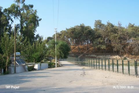 |
|
Type:
|
Mound |
|
Altitude:
|
150 m |
|
Region:
|
Mediterranean |
|
Province:
|
Mersin |
|
District:
|
Tarsus |
|
Village:
|
Merkez |
|
Investigation Method:
|
Excavation |
|
Period:
|
Ceramic |
|
|
|
 |
|
| Location: The site lies in Gözlükule Quarter; southwest of Tarsus District northeast of Içel Province. The mound is known as "Tarsus" in some archaeological publications. |
| Geography and Environment: Flat and conical mound is 25 m long; and has a diameter of 300 m. Modern settlements surround the site; today. Tarsus Stream passes by the eastern side. The settlement is thought to be located very close to the sea during the first settlement. |
| History: |
| Research and Excavation: The excavations carried out in Gözlükule can be grouped into two as before and after the World War II. The 1934 and 1936-37 excavations were conducted before the World War II. Following the war; it was re-excavated by H. Goldman of the College of Bryn Mawr in the name of the American-Tarsus exploration team in 1947-1949. The Chalcolithic Age levels were revealed in a 3.5x4.5 m trench [Goldman 1956:fig.1; 2]. The water table prevented the excavators to reach the virgin soil. Late Chalcolithic Age graves were revealed in the trenches on the southeastern slope of the mound and in the plain; below it [Goldman 1956:6-7]. In September 2000; a team from the Bogaziçi University; Faculty of Science-Letters; History Department made some preliminary preparations with M.J. Mellink who is also a member of the old excavation team. In 2000; researches were started in Gözlükule and the region. Studies are being continued. Excavations were resumed by Bosphorus University in 2007 under A. Özyar It takes place in the registered archaeological sites list prepared by Ministry of Culture and Tourism. |
| Stratigraphy: The excavations revealed that there was continuous habitation here from the Neolithic to the Islamic Period. Neolithic material is buried beneath 30.5 and 32 meters of cultural deposit. Due to limited excavation; the Neolithic could be studied only in a 1.25 square meter area and was thus a sounding rather than a full excavation. Virgin soil could not be reached because the water-table of the plain was reached at 32 m beneath the surface of the mound. |
| Small Finds: Architecture: Well plastered stone and pisé walls were found in the occupational phases dated to the Neolithic. Because the exposed area was so small; the house plans and the types of structures could not be determined. Over the plastered layer was a layer of ash with a few limestone fragments of what appears to be a column. These remains suggest that the excavated structure was a type of cult area [Goldmann 1956:5] [Yakar 1991:136]. Pottery: The ceramic fragments assigned to the Neolithic were analyzed by M. Mellink. Mellink separated them into two categories: Dark Burnished Ware and Light Coarse Ware. The Dark Burnished Ware is comprised of ware with black-brown and brick colored surface color. Closed vessels dominate. Very rarely the ware is impressed with nail and shell. Ware with black; beige and red burnishing can also be found. It often has mica inclusions. They are hard and breakable. Closed and flaring vessel forms are common. The Light Coarse Ware; on the other hand; is comprised of sand; grit and shell tempered; buff colored ware with dark cores. Some are slipped. Large jars and flaring bowls are common. The forms are flat bottomed. A third rarer type is a thick walled; grit tempered; red-burnished ware. The interdisciplinary research on Neolithic Age sherds performed by A. Özyar and G. Danisman in 2006 were completed by B. Aksoy and it was summarized under three main headings. The first of these covers dark burnished ware and consists of two sections: dark burnished and whole mouth ware, black fine ware and beige polished ware. The second group consists of light granulated ware. The third group of ware consists of red polished ware with thin walls [Özyar-Danisman 2009:388]. Chipped Stone: Obsidian is the most common raw material used in chipped stone tool making. Many small obsidian blades and flakes are reported to have been found [Todd 1980:144]. Microliths are nonexistent. In addition to cores; sickle-like special purpose tools were found. Although few chipped stone tools were excavated from the Neolithic layers; there were many chipped stone tools from this period on the surface of the mound including pressure flaked biface points (spear-heads; arrow-heads). These types of points have also been found at the neighboring site of Mersin; Yumuktepe. The chipped stone tools at Gözlükule show close affinity with from Yumuktepe tools. Ground Stone: Grinding stones and polished stone celts were found. |
| Remains: |
| Interpretation and Dating: It is assumed that the first settlement at Gözlükule dates to the Aceramic Neolithic Period although this cannot be confirmed because excavations were forced to stop due to the elevated water-table of the plain. The Ceramic Neolithic layer exposed does not provide a comprehensive understanding of the Neolithic settlement at the site. The ceramics from the earliest level at the site; which Goldman assigned to pre-5;000 BC; have also been assigned to the sixth millennium BC. In ASPRO; this level of the site has been placed in the fifth and sixth phases and is thus uncalibrated to 8.000-7.000 BP [Hours et al. 1994:337]. |