|
©The Archaeological Settlements of Turkey - TAY Project
|
|
|
|
|
|
Gölde |
|
|
For site maps and drawings please click on the picture...  |
For photographs please click on the photo... 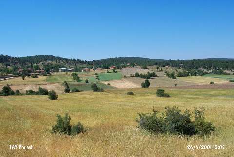 |
|
Type:
|
Mound |
|
Altitude:
|
1300 m |
|
Region:
|
Mediterranean |
|
Province:
|
Burdur |
|
District:
|
Merkez |
|
Village:
|
Yesildag |
|
Investigation Method:
|
Survey |
|
Period:
|
Ceramic |
|
|
|
 |
|
| Location: This site lies approximately 30 km south of the city of Burdur in the village of Yesildag; which used to be called Gölde. |
| Geography and Environment: The mound lies on the southeastern skirts of Mount Kestel; on 1;550 m high Kiziltepe. It lies on a plateau which is surrounded by high mountains. The site lies at the confluence of Bozçay Stream; which springs from the Alagöz Spring and eventually empties into Burdur Lake and Geçdin Stream. Because of the confluence of these streams; the area locally is called the Gölde Watershed. The mound was named by M. Özsait after the old name of the village of Yesildag. |
| History: |
| Research and Excavation: The site was discovered in 1983 by M.Özsait. It takes place in the registered archaeological sites list prepared by Ministry of Culture and Tourism. |
| Stratigraphy: Analysis of the ceramics at Gölde Höyük suggests that there was prehistoric habitation of the site. Hellenistic and Roman sherds were discovered on the northeastern side of the mound. |
| Small Finds: Pottery: The surface of the mound yielded hand-made; well fired ware; slipped with buff; reddish-pink and brown slip; well burnished and thin walled ware [Özsait 1989a:2-3]. Sherds with lugs have also been found. Chipped Stone: Obsidian and flint cores; blades; and scrapers were found [Özsait 1991b:lev.II/18-28]. |
| Remains: |
| Interpretation and Dating: The settlement at Gölde was deserted at the end of the Late Neolithic. The ceramics collected from the surface resemble Hacilar IX-VI ware. Gölde Höyük is close to the mound sites of Hacilar and Kuruçay and can thus be evaluated in this wider horizon style. |