|
©The Archaeological Settlements of Turkey - TAY Project
|
|
|
|
|
|
Van Kalesi |
|
|
For site maps and drawings please click on the picture... 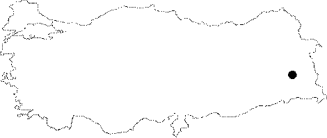 |
For photographs please click on the photo...  |
|
Type:
|
Fortress |
|
Altitude:
|
m |
|
Region:
|
Eastern Anatolia |
|
Province:
|
Van |
|
District:
|
Merkez |
|
Village:
|
Merkez |
|
Investigation Method:
|
Excavation |
|
Period:
|
Middle Iron Age |
|
|
|
  |
|
| Location: Tushpa, the capital of the Urartian Kingdom located at the center of Van is known as the Van Fortress. |
| Geography and Environment: It is situated on the steep Van rocks rising at the center of the Van Plain. Eocene calcareous rocks are approximately 1.5 km long in east-west direction. It measures 70-80 m in north-south in direction, and 100 m in height. |
| History: |
| Research and Excavation: It was initially surveyed by F.E. Schulz in 1827. In 1839, a French archaeologist C. Texier produced engravings of the city of Van and the fortress. In 1846, X. Hommaire visited the city, followed by H. Layard and his assistant H. Rassam in 1849, and then F. Burnaby in 1876, H. Rassam in 1877, H.F. Tozer in 1879, E. Chantre in 1881, P. Müler-Simonis in 1888, and K.E.W. Belck in 1891. C.F. Lehmann-Haupt also contributed to the research made by Belck. The first excavation at the fortress was conducted by I.A. Orbeli in 1936. Among the scientists who came from the USA between 1937-40, E.B. Reilly performed excavations at Tilkitepe while Siluz and Kirsopp Lake excavated Van. In 1956, C.A. Burney conducted a survey at the Van fortress and themound of the fortress. The first survey and excavation by Turkish scientists was conducted under the direction of A. Erzen between 1959 and 1961 at the Van fortress. In 1969, M. Salvini, and then A.M. Dinçol examined the Urartian inscriptions in the fortress. He also took part in the photogrametrical planning studies along with R. Naumann and A. Erzen between 1972-73. Afterwards, M.T. Tarhan prepared the projects called "The National Project of History of Van Fortress and Ancient Van" between 1983-87and "The Old City of Van and the Van Fortress-Turkey, Istanbul 1986" as a UNESCO project in 1986. Tarhan conducted the excavations at Van Fortress and Ancient City of Van between 1987-91. E. Konyar restarted the excavation studies in 2012. |
| Stratigraphy: There is an uninterrupted chain of settlements at the Van Fortress (Tushpa) from the Early Bronze Age until the end of WWI, which covers a span of roughly five thousand years: Hurrians, Urartians, Medes, Persians, Parthians, Byzantians, Vassals, Vasbouragans, Sassanids, Seljuks, Karakoyunlu and Akkoyunlu Turkomans, Safavids and Ottomans. |
| Small Finds: Sardurburcu/Madirburç: It rises in a plain to the north on the northwestern skirts of the fortress on the western end. It was named "Sardurburcu" by C.F. Lehmann-Haupt in 1898. It is locally called "Madirburç". It is a building that belongs to the oldest dynasty of Tushpa. It was built by King Sarduri I, who was the mightiest of the founder kings. It has a rectangular plan that measures approximately 47x13 m. The remaining five courses of stones are approximately 4 m high in average. It was built with elaborately dressed limestone blocks of 8-10 tons each. There are construction inscriptions, repeated three times on the east, and three times on the west façades of these limestone blocks. Citadel: It constitutes the most impressive section of the fortress. It is the highest point of the fortress. The citadel walls reaching up to a height of 7-8 m at several points belong to the Urartian Period. The stone and adobe additions on the fortifications belong to a long span expanding from the fall of the Urartian Kingdom to the WW I. The first palace and the earliest temple of the capital Tushpa are situated at this spot. Kings' Tombs: The rock tombs of the kings with a high level masonry are among the most important structures of the Urartian monumental rock tombs. The façades of the tombs located right below the citadel look over to the cliff to the south. These structures consist of a large hall and grave chambers communicating with the hall. Tomb of King Sarduri I: It is certain that the Grand Platform was built for this monumental tomb. The rock facing the south was carved to form a monumental façade. There is a light aperture over the gate. The hall is interconnected with the four grave chambers. The term used for the tomb is the "Neft Kuyusu Tomb" or the "Tomb of Menua" (This monumental grave was dated to the Urartian King Sarduri I by M.T. Tarhan). Tomb of Ishpuini and Menua: This tomb, with its two main halls built on the main platform, and its entrance facing east, should have belonged to Ishpuini and his son Menua, who ruled the Urartian Kingdom together. The two main halls are the proof of this joint reign. Two grave chambers are accessible through the front hall which presumably belongs to Ishpuini. The second hall, presumably belonging to Menua, is interconnected with the grave chamber. These are known as "the Tomb of Founders" or "Citadel Grave" in the literature. Tomb of King Sarduri II: It is situated to the east of the East Ditch. It has a gorgeous appearance with its monumental rock platform, stairs descending to the platform, stairs to the entrance, a bench of the hall, and a façade architecture. Three grave chambers are accessible from the main hall. It is called the "Tomn of Sarduri II" or the "East Tomb". Grave in Cremation tradition: This is the easternmost grave structure. It consists of solely a large hall. Some horizontal niches were carved into the eastern, western and northern walls, extending almost along with the length of the entire wall. Approximately 78 rounded cavities for pedestals lie inside the niches. Tomb of Argishti I: It lies outside the West Ditch to the west of "New Palace". It was also referred as the "Horhor Cave" in related scientific texts. It is certain that it belongs to Argishti I. The kingdom almanacs were written on the entrance façade in columns. The entrance is reached descending the steps. The monumental grave consists of five grave chambers, interconnected with a main hall. There are 34 niches on the wall. A grave chamber called "Little Horhor Cave" is located right below this grave structure. New Palace: This dynastic building is outside the citadel, located in an area between the West Ditch and the Tomb of Argishti I rising on stepped platforms. Due to its relation to the monumental grave to the west, M. T. Tarhan assume that it was built by Argishti I. Most of the remains were unearthed during the excavations between 1987-90. The floors and parts of the walls of 12 buildings in various sizes were entirely carved out of the bedrock. The Menua Sirshin: This monumental building was also described as "Menua Hall" in historical/archaeological literature. It has access to a natural terrace on the northern slope right below the fortress. Since it was found in situ it could have been identified as one of the datable dynastic buildings. It was completely carved out of the bedrock. The building was exposed during the excavations between 1989 and 1990. Sirshin is a barn where the votive animals were kept. "Girl with Mother/Analikiz" Sanctuary: It was almost entirely carved into the bedrock. It is located on the northeastern slope of the fortress. It was built by Sarduri II. The local term for the sanctuary is being also used in the literature; and it is called the "Girl with Mother" or "Treasury Gate". Among the most impressive architectural elements are two large niches and two gigantic steles standing on basalt pedestals inside these niches, a large platform on which the ceremonies took place and seating benches of the spectators, and canals where the blood of the sacrified animals ran through. Inscriptions: There are more than 100 Urartian inscriptions. Some of them are in the Museum of Van while some are in the Museum of Georgia. And only the photograph of one of the inscriptions is available in the Museum of Yerevan. Fountain of Menua: It located in the northern skirts of the castle. There are three identical inscriptions inscribed on the panels inside 3 niches that were formed by truncating the bedrock. It is stated that this structure is a fountain built by Menua due to the word "taramanili" considered to correspond fountain word. Horhor Fountains: It located in the southwest of the castle. The niche of the fountain measures 142x104x65 cm. There is a pool measuring 95x75x18 cm in size under the niche. There is a canal at the northeast corner of the pool. It is entirely carved into the bedrock. To the north of the fountain, there are stairs providing passage to the castle [Konyar et al. 2014: 358-64]. |
| Remains: |
| Interpretation and Dating: The researches on the Van Fortress were initiated in 1827. Therefore, it is among the first settlements investigated in Eastern Anatolia. K. Moses who lived in the 5th century AD wrote that it was the Assyrian Queen Semiramis who built the Van Fortress. However, later scientific researchs showed that the fortress had been inhabited starting from the Early Bronze Age, and it was the capital city of Urartians. The Urartian inscriptions found in the fortress, which were high in number, were decyphered by M. Salvini and A.M. Dinçol. The data on the rock graves in the fortress went through changes following the studies carried out by M.T. Tarhan. The rock grave called the "Neft Kuyusu Tomb" or the "Tomb of Menua" in literature was named by Tarhan as the "Tomb of Sarduri I"; the one called the "Citadel Tomb" was called "Tomb of Ishpuini and Menua"; and finally the one that is called in literature as "Horhor Cave" was changed to the "Tomb of Argishti I". The Van fortress, which is one of the most important fortresses of Anatolia had been uninterruptedly inhabited for a 5 thousand years. |

