|
©The Archaeological Settlements of Turkey - TAY Project
|
|
|
|
|
|
Sirinlikale |
|
|
For site maps and drawings please click on the picture... 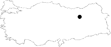 |
For photographs please click on the photo...  |
|
Type:
|
Fortress |
|
Altitude:
|
m |
|
Region:
|
Eastern Anatolia |
|
Province:
|
Erzincan |
|
District:
|
Tercan |
|
Village:
|
Konarli |
|
Investigation Method:
|
Survey |
|
Period:
|
Middle Iron Age |
|
|
|
 |
|
| Location: It lies 50 km southeast of the Tercan District in Erzincan. It can be accessed through the road from Tercan to Çat. Kurukol and Yalinkaya villages are reached after Karasu. And, after Yaylayolu, Göktas and Besgöze villages comes Tuzluçay. Sirinkale rises on the bank of the Sihköy Stream bank which flows parallel to Tuzluçay. |
| Geography and Environment: The hill on which the fortress stands with a rocky top and the east and south sides being 50 m high above the river bed descends down to a steep cliff, which provides a natural protection on the southwest. |
| History: |
| Research and Excavation: Sirinlikale was discovered during a survey conducted under the direction of Fahri Isik et al. |
| Stratigraphy: It appears that the fortress had been occupied during the Urartu Period and Middle Age. |
| Small Finds: Architecture: Despite recovery of Urartian pottery on the fortress and right accross it on the hill rising on the eastern bank of the river, no wall remains are observed. A tremendous fragment of the wall remains from the Middle Age has survived to the present on the northern edge of the citadel. Sirinlikale bears Urartian characteristics in terms of construction technique. The two cisterns carved in the form of storages to the north of the rocky plateau, and the north and south rock tunnels lying to the east of the citadel are original features of the Urartian construction technique. There are also two Urartian rock graves carved into the rock mass in the East Citadel. Rock graves: Two rock graves were found at Sirinlikale: Grave I: It is at the bottom of the steep eastern slope on a smoothed rock surface. Easily accessible from the direction of Sihköy Stream facing the graves, it has an elaborate masonry work. The proper rectangular gate which provides access to the grave is surrounded by a fascia on inside and outside. The gate which measures 0.60x0.93x1.23 m in dimensions allows access into the main chamber of 2.75x3.60x2.10 m. The first thing on the floor is a pit of poor rectangular shape measuring 0.20x0.40x0.10 m. Along the southern wall are lined six holes with a diameter of 0.10 m, which lie 0,40 m apart from each other. The entrance to the rear chamber measures 0.68x0.95x1.27 m in dimensions, piercing the southern wall. The rear chamber with an almost square plan measures 3.80x3.90x2.25 m in dimensions. The rear chamber which is 0.25 m lower than the main chamber is accessed with a step-like threshold. The northeastern corner of the chamber has been heavily destroyed. Grave II: The rock grave lying to the south of the first grave on the same rock faces east. The grave is accessed through a gate of 0.70x0.30x1.0 m, clearly surrounded by a fascia on all three sides with a flight of two steps of 0.20 and 0.40 m in heights. The height of the main chamber measuring 3.12x3.85x2.15 m in dimensions reaches up to 2.20 m in the first 2 m which has a poor masonry. Other than this section, it has a qualified masonry. The central part of the rear wall is pierced by a 0.40 m high section of 2,12x1,95x1,40-1,70 m extending along the grave and accessible with one step. The diameters of the 14 holes arranged in two rows in front of the rear wall of "Ewan" vary from 5 to 8 cm. There is a rectangular pit that measures 0.25x0.30x0.13 m in the northern corner of the main chamber, and one hole on each end of the steps that extend in that section. |
| Remains: |
| Interpretation and Dating: Sirinlikale which lies within boundaries of the Tercan District in Erzincan is located on one of the natural routes between Erzincan and Erzurum. The fortress and the rock graves command the region, very suitable for defense purposes. Sirinlikale had been inhabited during the Middle Iron Age and the Middle Age. The hegemony of the Urartu Kindgom in the region during the Middle Iron Age can be perceived from the building remains and sherds found in the fortress. Sirinlikale may provide significant information about expansion of the Urartu Kingdom to the west. |