|
©The Archaeological Settlements of Turkey - TAY Project
|
|
|
|
|
 |
Izmit Sehir Surlari |
|
|
|
|
For site maps and drawings please click on the picture... 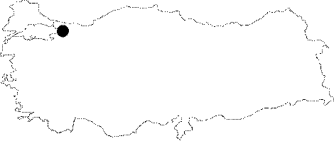 |
For photographs please click on the photo... 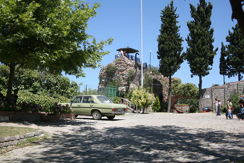 |
|
|
|
|
Type:
|
Fortification |
|
Plan Type:
|
|
|
Year of Costruction:
|
12th c. |
|
Phase:
|
Middle |
|
Investigation Method:
|
Survey |
|
Altitude:
|
200 |
|
|
|
|
Region:
|
Marmara |
|
Province:
|
Kocaeli |
|
District:
|
Merkez |
|
Village:
|
Merkez |
|
Antique Name:
|
Nicomedia |
|
|
|
  |
|
| Location: The fortifications enclose the city center of Izmit. The remains of the wall from the Roman Period, which are approximately 6 km long, are traceable randomly inside the city, while a major part of the wall remains from the Byzantine Period are on the hill to the northeast of the city and the vicinity (the radar base), and some other parts are in the Turgut Quarter [Foss 1996a:29]. Some of the inside walls are situated on Saadettin Yalim Avenue [TAYEx 10.07.2008]. |
| Geography and Environment: The traces of the outer walls can be observed, even tough sometimes they are buried under the ground, mainly on the hill to the northeast of Hisar. Most of the outer walls, which are over 6 km long including tophills of the city have been obscured by the modern settlement. This section of the walls ends with a tower higher than 10 m. The remaining extant parts of the fortifications extend in the Turgut Quarter alongside the ridge. The city walls, also enclosing the city along the coast, and belonging to the Izmit Harbor, which extend to the east were left under the soil during the road construction. Furthermore, some western extension of these walls was run into during the construction of the underground passage to provide accessibility for SEKA (Turkish Cellulose & Paper Factories) to the city. These walls didn't survive either [Firatli 1959:18; Foss 2002:50-52]. The northern section of Hisar, which overlooks the city, including the Mosque of Orhan in the Orhan Quarter, has been better preserved. Although the remains, which belong to the other parts of the fortifications are behind the residential buildings, or inside the gardens, they can be traced [Foss 1986:138]. |
| Research and Excavation: The first of the systematic surveys on the fortifications was performed by Pogodin and Wulf in the late 19th century [Pogodin-Wulf 1897]. The retaining walls of the Middle Age in the provinces of Kocaeli and Kütahya were surveyed and published in detail by C. Foss within the scope of the "Medieval Castles of Anatolia" project by the British Archaeological Institute in Ankara in 1984 [Foss 1986; Foss 1996a; Foss 2002]. |
| Description: Building Phases: It is reported that the outer walls were first built during the reign of Nicomedes I (278-250 BC) [Parmaksizoglu 1972:477]. The fact that there are no apparent traces of a repair on these walls, of which the course can be followed today, indicates that they belong to a single period as a whole. They were built during the Diocletian's period when Nicomedia was the capital of the Roman Empire (284-305), and were repaired following the 358 earthquake, which devastated the city. Based on the remains, it seems that they were not durable, and they had been neglected following the loss of interest in Nicomedia during the 7th century just as it was the case in the 4th century [Foss 2002:67, 70-71]. Although parts of the rectangular castle seem to be adjoined with the Roman fortifications, the outer wall is, in general, dated to the Komnenid Dynasty Period. The northern section which is relatively well-preserved, contains traces of four main periods between the 4th and the 15th centuries. It seems that a very small part of Hisar was repaired by the Crusaders in 1204, and another repair took place during the Lascarid Dynasty Period. The repairs that were carried out between the 14th and the 15th centuries in the Ottoman Period, can be explained as repair of the damaged sections (particularly the environs of the South Gate) during the siege in the Sultan Orhan's Period. It is also likely that the walls might have been repaired following the siege of the city by Marshall Boucicault. Although it is assumed that the triangular section on the northeastern corner of Hisar was added during the reign of Sultan Mehmed I, absence of any reason for that suggests the possibility of a relation with the earthquake in 1509[Vural 1977:51; Foss 1986:138-139; Foss 2002:71-73]. Architectural Features: The outer walls enclosed the city both on the sea shore, and the land, and reached to a total length of 6 km [Foss 2002:50]. Although a masonry of the Roman Period is observed on the remaining walls, parts from the Hellenistic Period are also seen [Firatli 1971:13; Vural 1977:45]. The core of the walls consists of bricks, and rough local stones added onto white mortar with small stones. The complete body of the wall is interrupted by four courses of bricks, which are 3 cm thick, and 30 cm long, and these courses are 1 m apart from each other. The walls are pierced by towers either in circular or square plans, built in uneven distances from each other. Since there are no traces of the walkways and the crenels on the walls, the actual height could not be determined, but the thickness is consistently 3 m [Foss 2002:50-52]. The castle, which is located at a spot overlooking the city, is in rectangular plan. The northern part runs in parallel to the outer walls. The western wall makes a steep descent from the north to the south to make a right angle with the walls, and makes a turn towards the south near the Orhan Mosque. It later makes a curve towards the north, then again it stretches towards the south. Then it makes another curve towards the north, and continues southbound. With a final curve, it ends with the southern wall. The eastern wall forms a triangular projection at the center towards the east, and it is combined with the northern wall a little bit further [Vural 1977:47]. The northern section of the castle pierced by ten towers has been preserved better [Foss 1986:138]. These towers are circular and square in plan. The masonry technique of the castle includes two or three courses of bricks, followed by a single course of stones. However, at some places a single course of brick is followed by one course of stone. The bricks were laid vertically and horizontally between the courses of stones, formed by laying the stones side by side [Vural 1977:51]. |
| Finds: |
| Interpretation: It is reported that the ancient Nicomedia was enclosed by walls during the Hellenistic Period, and therefore the castle could originally have been the acropolis of Nicomedia [Firatli 1959:16; Firatli 1971:11]. Foss who conducted a systematic survey on the Izmit fortifications found traces of the Hellenistic walls, which he refers to have been built with thin cut limestones at the castle, however, he could not reach to any conclusion based on the available finds on whether these Hellenistic walls descended down to the sea or not [Foss 2002:70]. Tunay suggested that the remains that were uncovered during the foundation excavations inside a house in the market place in 1967 might have belonged to the sea walls from the Hellenistic Period [Tunay 1969:100]. |
| Destruction: Saraybahçe Municipality picnic area and facilities are located in the same area as Bayraktar Tower in the north. Both the tower and the walls are inside the public park. Many concrete steps were built and parapets were installed to provide access to the top of the tower. Heavy housing is also observed in the environs of the tower. There is a building to the south which is used as toilet and masjit. The ground was paved with cobblestones. The walls continue towards the southeast and southwest of the tower. Bagkale Residences Building Complex was built in the east. Housing is also observed in north direction. Two vaulted buildings are located underneath the tower. That building is used as a coffee shop named Santa Barbara Tower. Cobblestones were paved in this vaulted building, the walls were plastered with cement and electrical installations were performed. Walls can be traced inside the city and northwest of the acropolis. Hellenistic-Roman Period walls can be seen only partially at the lower levels due to vegetation. The inside fortress towers are located south of the ancient theater that continues towards west on the north slope. The Comnenid Period walls are situated over Hellenistic Period walls at this spot. Due to housing the walls can only be traced between houses. The walls lying in east- west direction were revealed during road construction in the south of the Army Officers' Club and north of the Teachers' Club House. These walls were revealed during the road tunnel constructions. The walls were built using stones and bricks and can be traced for about 1 km. During the road work an area of approximately 2.75 m in height was excavated. Tunnel and canal constructions continue and threat the recently found city walls just northeast of Seka Mosque [TAYEx 10.07.2008]. |

