|
|
||||
|
|
||||
|
Belpinar Karain |
||||
|
For cave maps and drawings please click on the picture... |
For photographs please click on the photo... |
|||
|
 |
|||
|
Type: |
Cave | |||
|
Altitude: |
m | |||
|
Depth: |
m | |||
|
Length: |
m | |||
|
Region: |
Mediterranean | |||
|
Province: |
Antalya | |||
|
District: |
Kemer | |||
|
Village: |
Beldibi | |||
|
|
||||
 |
||||
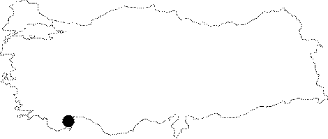
| Location: This cave site is southwest of the city of Antalya and northwest of the village of Beldibi. It is close to the site of Belbasi and lies on the northern slopes of the Belpinar Stream Valley; by the cliffs where the Belbasi Rock-Shelter is located. It is 3 km from Kumbucagi Rock Shelter. Although Bostanci has named this site Karain; in order to avoid confusion with the other Karain Cave in Antalya; he has differentiated this site by calling it the Belpinar Karain. The approximate location of this site has been shown in the schematic plan above. |
| Structural Properties and formation : |
| Research History: It was found in 1959 during the survey of E.Y. Bostanci. It has been reported that a small excavation was conducted; probably as a trial. |
| Findings: What survived to day are only horns of a geer figure carved on the rock. The base of the projected part of the rock resembles the body and head of an animal due to dripping waters. The digging pit opened in front of the cave by the villagers revealed flintstone microlith findings of blade and core. Among them; no geometric tools were found. The investigator suggests that those tools had been left by the Mesolithic/Epipalaeolithic hunters walking around. No detailed information has been supplied about the figural characteristics of the tools. |