|
|
||||
|
|
||||
|
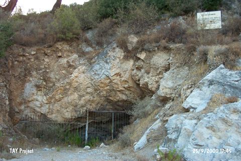
Peynirçiçegi Magarasi |
||||
|
For cave maps and drawings please click on the picture... |
For photographs please click on the photo... |
|||
|
 |
|||
|
Type: |
Cave | |||
|
Altitude: |
56 m | |||
|
Depth: |
-15 m | |||
|
Length: |
90 m | |||
|
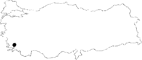
Region: |
Aegean | |||
|
Province: |
Mugla | |||
|
District: |
Bodrum | |||
|
Village: |
Gündogan | |||
|
|
||||
 |
||||
| Location: It is located on a rocky ridge 200 m south of the junction on Gölköy-Yalikavak motorway separating to Gündogan territory of Bodrum District of Mugla. |
| Structural Properties and formation : The entrance of the cave looks like the section of a circle with 9.4 m width and it is 2.5 m in height. A door made of iron bars closes the entrance. The entrance of the cave opens to a gallery; which is approximately 2.5 m high. The length of the gallery is 15.3 m and its widest part is 13 m. The floor of the gallery partly continues with a slope of 60 degrees so the space between the bottom and the roof of the cave increases. The gallery elevates at the roof and joins another gallery with a balcony and a narrow passage; and ends with this gallery. The gallery at the entrance divides in to two branches extending in north and south directions. There are two chimneys at the roof of the entrance of branch extending in north direction. This kind of chimney formations are also common at the onwards galleries of the cave and some of them are reaching the upper part of the hill which the cave is located on. When it is carried onward at the northern branch of the entrance gallery; it is observed that the cave is turning west and continuing with little descents and divides in to branches extending in south and west. The branch extending west ends with a gallery of 14.2 m width and 10 m roof height. The branch extending south is partly shallow roofed and opens to an other gallery which has a joint at the northern part to the entrance gallery. This gallery is the end of the southern extension of the cave. These three galleries; which are the biggest ones of the cave; are suitable to visit by their high roofs and wide passages. But this condition of the galleries caused pollution and destruction. Big garbage heaps which especially seen at the galleries with chimneys are also seen at the big galleries and they threaten the natural environment of the cave. |
| Research History: The first explorations were carried out by H. Özdas; and B. Berkaya; the archaeologists of the Bodrum Underwater Museum; and O. Hamza; the photographer in 1992 followed by I. Yalcinkaya; A. Ozten and B. Alpagut from the Ankara University in 1993-94. The cave was traversed and mapped during a research made by EMAK in 2004. |
| Findings: Evidence of Chalcolithic and Early Bronze Age settlements were observed during the soundings made by Ankara University. |