|
|
||||
|
|
||||
|
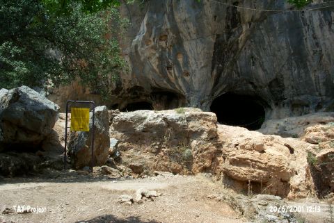
Karain Magarasi |
||||
|
For cave maps and drawings please click on the picture... |
For photographs please click on the photo... |
|||
|
 |
|||
|
Type: |
Cave | |||
|
Altitude: |
360 m | |||
|
Depth: |
-15 m | |||
|
Length: |
100 m | |||
|
Region: |
Mediterranean | |||
|
Province: |
Antalya | |||
|
District: |
Merkez | |||
|
Village: |
Yagca | |||
|
|
||||
 |
||||
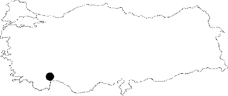
| Location: This cave site is approximately 27 km northwest of the city of Antalya; immediately northeast of the village of Yagca. It is connected to Antalya with an asphalt road and easy to reach. Code V 19 / 1. |
| Structural Properties and formation : It was naturally carved into the Cadir Hill by karstic events. The hill is situated on the calcareous steep slopes of the Cam (Katran) Mountain. It is within the Cretaceous aged Mesozoic limestones. |
| Research History: Famous with its Palaeolithic findings; a few potsherds from the Early Bronze Age were uncovered during the excavations led by I. Yalcinkaya. It is reported that the cave had been seasonally settled during that age [Harmankaya et al. 2002]. |
| Findings: Starting from the Lower Palaeolithic Age; it had been consistently inhabited during the Middle and Upper Palaeolithic; Neolithic; Chalcolithic; Early Bronze Ages; 2nd century BC and Classic Age. As a result; there is a cultural deposit of about 11 m thick. The longest and the most significant settlement was during the Palaeolithic Age. The settlement during the Classic Ages was mainly a sacrificial (temple) cave; and there are some Greek inscriptions and niches on the long wall and outer walls. The archaeological findings uncovered from the Karain Cave are exhibited in the Antalya Museum and the Karain Museum next to the cave. It was listed among the first degree Natural and Archaeological Sites in 1997. There are signs indicating the presence of bats [Barth-Brenner 1990:64]. |