|
|
||||
|
|
||||
|
Zeus |
||||
|
For cave maps and drawings please click on the picture... |
For photographs please click on the photo... |
|||
|
 |
|||
|
Type: |
Horizontal Cave | |||
|
Altitude: |
12 m | |||
|
Depth: |
-4 m | |||
|
Length: |
60 m | |||
|
Region: |
Aegean | |||
|
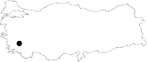
Province: |
Aydin | |||
|
District: |
Kusadasi | |||
|
Village: |
Güzelçamli | |||
|
|
||||
 |
||||
| It is located at the skirts of a mountain; very close to the Güzelcamli Village right before entering to the National Park of the Dilek Peninsula. It was developed along a fault within the Mesozoic aged dolomitic recrystallized limestones. The large mouth of the cave has been narrowed with blocks of rocks. No travertines are seen. It is a wet cave. It was explored and mapped by MTA. Due to the excceptional formation and sight of Zeus cave in terms of its harmony with the natural environment it was registered as second degree protection zone by the Izmir assembly II; for the protection of the natural and cultural resources; verdict no.5861 on 12.06.1996; and the related building zone plan no.10174 dated 17.10.2001 was approved (Katkı: Sedat Akkurnaz; 19.03.2007). |
| Location: |
| Structural Properties and formation : |
| Research History: |
| Findings: |