|
|
||||
|
|
||||
|
Sogucak |
||||
|
For cave maps and drawings please click on the picture... |
For photographs please click on the photo... |
|||
|
 |
|||
|
Type: |
Cave | |||
|
Altitude: |
1105 m | |||
|
Depth: |
+18 m | |||
|
Length: |
1051 m | |||
|
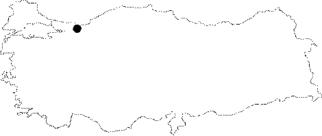
Region: |
Marmara | |||
|
Province: |
Sakarya | |||
|
District: |
Sapanca | |||
|
Village: |
Erdemli | |||
|
|
||||
 |
||||
| Location: It is located at the source of Istanbul Stream that empties in Sapanca Lake; north of Sogucak Upland; east of the Samanli Mountains that are very steep in the south of Sapanca Lake. |
| Structural Properties and formation : Sogucak Cave is situated on the declination area of Armutlu Peninsula (Samanli Mountains) which is between the northern (Sakarya-Izmit Gulf) and southern (Geyve Iznik Lake) branches of the Northern Anatolia Fault Line. Sogucak Cave which is at the source location of Istanbul Stream is situated on the northern edge of Sogucak Upland; that empties in Sapanca Lake. The cave primarily extends in south direction approximately 40 m long; then connects with the main gallery in east-west direction which is 150 m long. Inside the gallery it is filled with large blocks; and almost completely fossilized. The cave end is at +10 m height according to the entrance; and bears a lake of 0.5 m in depth; then a closed siphon. The half-active gallery splits from the last section of the fossilized main gallery. This section which expands in north-south; and NW-SE directions; consists mostly of two stories; and has a grilled and wavy structure in line with the direction of the crack and the layer. The fossil storey bearing dense dripstone formations is at the upper storey; and 3-4 m below it; is the active storey. The active storey basin is filled with pebbles; and sand piles; and the subsurface stream flows both in summer and winter. Sogucak has the characteristics of a multi-period development; active/half-active/fossil stories; and it is a spring type cave. the fossil storey that forms the main gallery is the largest section of the cave with the highest ceiling height. Therefore it went through a number of collapses; and the floor is filled with large blocks. On the other hand the tunnel shaped; two storey branch that splits from the main gallery is narrower; and its galleries have lower ceilings. Pits or vertical tunnels 2-4 m long provide connection between the stories. The upper storey of this section (fossil storey) is filled with dripstone formations (stalactites; stalagmites; columns; bacon rinds; eccentrics; and dripstone ponds). Additionally sand and pebbles bench are frequently observed. On the other hand the presence of water wear structures and piles of sand/pebble is dominant in the lower storey. The width of the fossil and active stories is 1-4 m and the ceiling height is 0.5 - 7 m. |
| Research History: It was researched by the Geological Studies Department of the MTA General Directorate and published in 2002. As a result of the 2009 campaign the length of the cave which was initially measured as 552 m, was changed as 1051 m. |
| Findings: Presence of bats is observed in different sections of the depression hall. On the other hand there are cave butterflies in the middle and last sections of the main gallery. |