|
|
||||
|
|
||||
|
Inkese |
||||
|
For cave maps and drawings please click on the picture... |
For photographs please click on the photo... |
|||
|
 |
|||
|
Type: |
Horizontal Cave | |||
|
Altitude: |
250 m | |||
|
Depth: |
-80 m | |||
|
Length: |
355 m | |||
|
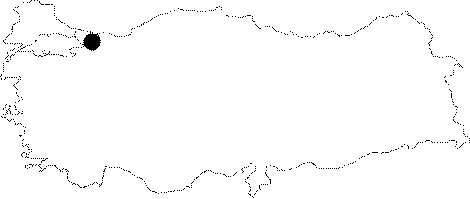
Region: |
Marmara | |||
|
Province: |
Istanbul | |||
|
District: |
Sile | |||
|
Village: |
Hacili | |||
|
|
||||
 |
||||
| Location: It lies to the southeast of Sile. It is located 3 km northwest of the Hacilli Village and 1.5 km south of the Sortullu Village. It can be reached from the Sile-Agva-Osmanköy road. After passing through the villages of Osmanköy and Sortullu; there is a muddy road on the right side while entering to the Hacilli Village; and this road leads to the Doganyuvasi Hill by passing nearby the entrance of the cave. It is connected with the Sucikan Cave |
| Structural Properties and formation : Inkese Cave lies nearby to the road of Hacili-Sortullu-Tepemanayir on a low plateau with 250m of attitude located 18 km southeast of Sile. The mouth of the cave located 200m above the valley base, is situated in the third of the doline series laying in the side branch of Goksu Creek. Goksu Creek being the main river of region is nestled in two: Dissolvable limestones of Skythian-Anisian (Lower and middle Triassic) and andesite of Turonian (Upper cretaceous). Over these formations there exists Pliocene cover somewhere in the ridges with a reddish and dirty yellow clay and pebble. The main river, Goksu Creek, though to be forced towards the south of Hacili is located on a fault of directing NS. In addition, around the creek there are deformed drainage systems one is Doganyuvasi Tepe (308 m). Surfacial drainage have almost turned into a a drainage in underground. The gallery giving way to this underground stream begins with Inkese Cave in the attitude of 250m in the direction of W-NW and reaches Sucikani Cave in Sucikani Spring Mevkii in the attitude of 170m with E-SE direction. Cave is formed in clayey limestones in Skythian (Lower Triassic) and dolomitic limestone layer of ±200-800m thickness, light-dark gray, beige like in color, mid-thick pieced dolomitic fossil, thinly patterned, nodule of fire stone in lower levels in Anisian (Mid-Triassic) [Ozdemir et al. 1973]. Additionally, under dolomitic limestone, there is clayey limestone with ± 50-225 m of thickness involving silt stones and otolitic layer alternated; yellowish gray in color, mid-thin layered, rather hard, plentifully fossilized, and its surface is formed as meandering lines of vermes [Ozdemir et al. 1973]. The mouth of the inkese Cave meets the mouth of doline laying in the south of a doline with 200m in diameter. There is also a water resource outflowing to surface in the south of this doline. In the same formation Yukari Kisla Cave, not to be find a convenient condition to develop, also lies in environs and in the south of Inkese Cave. Youth tectonic motion is proved by that 2-5 degrees of northwardly sloped surface abraded, and so deposit cover showing the same character; an aged fluvial-karstic depression turned into doline series; cave while being a secondary surfacial branch having turned into an underground drainage place; being of many karstic resources in the environs; being of meanders, sloped terraces, crack in slopes, vacant beds and especially sand-pebble, even deposits of conglomerate, stocked in two levels in cave with 1m of interval [Ardos 1979; Sengör 1980; Ertek 1990 and 1995]. Inkese Cave originated from karstic formation, is formed by the underground water abrading clayey and dolomitic limestones where cave lies. Cave is active where underground stream pass due to the clayey limestone to become an impervious zone. In arid and dry seasons when rate of flow decreases, the mouth of Inkese cave is accessible to pass up to the mouth of Sucikan. Only an experienced caver would rather to pass the route with hip boots, cave cloth. Additionally, there is a fully watery and long siphon passage in side branch of the main gallery. Inkese Cave begins with a mouth that water inflows. Depression-shaped mouth with 10m in diameter narrows towards the direction of south in 4 m of distance up to 5m in diameter. 3m of descent opens to large hall with 24x9,5 m of size and 13 m of height. Large hall was suggested to be an old church with reference to the mihrap having fresco on southwestern wall and the steps. 8m above the mihrap there is a 12 m - dry branch of which base is covered with silt. There is a watery branch incorporating into large hall under the entrance with a mouth sized as 1,5x3 m; and flowing along the main gallery. Turning 15m to left side of the main gallery, the height decreases to a size of 5x3 m. In hall and 1m below the hall, the base is covered with edged and huge blocks. On the cracks in ceiling there is dipstones, stalactites in just a pen length. Furthermore white travertines were encountered on the wall of main gallery. Passing through the 18m of gallery the height ascends to 8m. On the right side there is a 27m of side branch of which base is silty due to the disappearance of water in 4 m - exit. The end continues to descent till 50x40 m. The main gallery continuing by descending to left or, north direction has 32m of length and narrows up to 1,5m of width and 1,75m of height. There is a stream going among the rocks on base. The gallery, thus, settled on the surface of layer turns to east side with 90 degrees of angle. After a 22m of length, the base of the gallery becomes fully watered with a height above knee. The height is 2m and the width is 3m in this part where there is no any stalactites and stalagmites. The height decreases to 75 cm in somewhere in gallery extending 30m of distance with water. In the shallow parts of the water there is largish sand and clay. Gallery splits into two branch in 5m of distance. The left branch incorporates into other watery branch in probably so close place to exit. Main gallery nestled in a fault is curled-shaped. At the base there is large blocks instead of water. On the ceiling there is stalactites along the cracks. From the watered part to Yamac Copulu the length is 104m. In the east part of the cave where a wind current exists, life forms in cave increases in different species. In this gallery the temperature was sized as 15 degrees of centigrade in September 1995. The main gallery is cut by the Yamac Copulu (Yamac Doline) with the size of 75x50 cm. There is a way to the lower mouth, Sucikan Cave, to be accessible with 4m of descent from the base covered with 2x3 m of blocks. Then, there is 45 m - gallery laying along a fault in limestones. There is white travertines in it. After the descent in the north or, right side there is a fully watery gallery. Sucikan Cave has a width of 3m and a height varying between 12-15m. The mouth of this cave meets the depression zone. Under the exit the karstic water resource again outflows to surface. This water is collected from such three resources that one originates from the west side of the doline that Inkese Cave lies; the other incorporates into the hall at the beginning of Inkese Cave; and the third the drained water from the surface accumulates in the pocket of karstic formation. Inkese Cave with a 355m of length, though, is still an active cave, there is a fossil and dry branch between Yol Copulu Doline-Sucikan Cave. The falling down on ceiling and the depression on the base proves the branch to be aged. According to these evidences and the youth tectonic motions, cave was suggested to place in the period between the end of Pliocene and the beginning of the Quaternary. |
| Research History: In 1986 cave was surveyed by BUMAK but not to be mapped. Later on, the map was completed in the course of ÔEurasian Bridge Ô99' in 1999. Cave known by the villagers inhabiting in Hacili and Sortullu had assessed and also mapped in the sense of cavity processes by Ertek, T.A. and his team researching the geomorphology of Kocaeli Peninsula in 1980's [Ertek 1990 and 1995]. |
| Findings: In different zones of the Inkese Cave due to the adequate supply of oxygen there is mammal, arachnoid, diptera, cave mouse, dark brown spider, transparent spider, millipede, mosquito adopted to the ecological conditions of cave (luminous, semi-luminous, illuminous, watery, dry). |