|
|
||||
|
|
||||
|
Gürlek |
||||
|
For cave maps and drawings please click on the picture... |
For photographs please click on the photo... |
|||
|
 |
|||
|
Type: |
Horizontal Cave | |||
|
Altitude: |
m | |||
|
Depth: |
+40 m | |||
|
Length: |
241 m | |||
|
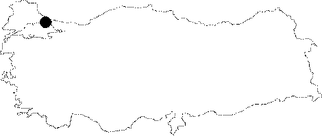
Region: |
Marmara | |||
|
Province: |
Istanbul | |||
|
District: |
Sile | |||
|
Village: |
Hacilli | |||
|
|
||||
 |
||||
| Location: It lies to southeast of the Hacilli Village and Sile District. The mouth is situated on the edge of the fifth whirlpool lying to the east of the steep slope and south of the location where the Degirmen Creek; which joins the Göksu Creek; is winding [Ertek et al. 1998:76]. |
| Structural Properties and formation : The valley of Degirmen Creek is abraded steeply and deeply. The slopes around it are symmetrical. There are many sloped faults and eleven ponded pothole in 5-12 m of depth. Creek forms a northeastwardly concave meander on the east slopes, before Goksu River. Sloped faults, waterflow of few meters height, small ponds, ponded potholes, meanders constitutes a few evidences of the youth tectonic motions in the formation of Creek [Ertek 1995]. The conglomerated levels stacked with 1m of intervals in different grades is also to be added. It is formed by the underground water abrading the intensive Triassic karstic limestones. Besides few small halls in the gallery, a steep wall giving a sole person way shows water having more mechanic affect than chemical one. That main gallery ends up with branches of tree and a steep wall is an evidence of a depression. Stalactites, additionally a few small stalagmites and columns on the wall and the base of gallery, umbrella-formed, white stalactites consisting travertines on the wall of main gallery are proves the continuity of formation. It was also suggested that the lacier and lichenous travertines shows water flowing over limestones. The strong flow in the entrance and shoal ponds sometimes reaching to the depth of galena shows cave to be more active in rainy seasons. As a result of that surfacial water inflowing through faults due to youthening of region by the last tectonic elevations after Peneplen formation in Pliocene around Sile in Kocaeli Peninsula, it was assumed that the cave has been formed in late Pliocene and early Quaternary [Ertek 1995]. Hydrology: Understandable as it is with its name, Gurleyen Cave has a roaring mouth and thus, inner parts of the cave is active and watery. In summer season, cave has four shoal ponds in it. Careful the mouth that in rainy season it fills with water becomes dangerous. Thus, the slope of mouth covered with lichenous travertines. Meterology: The outer temperature of cave is 24,5 degrees of centigrade and at the end in 241 m of length it decreases to 16 degrees of centigrade (9.9.1995). |
| Research History: The cave was firstly mapped by Ertek. In Addition it was also surveyed by BUMAK in 1986. |
| Findings: Human skeletons, pots, oven were encountered in cave. The skeleton was estimated to be reminded from the East Roman Period. There exists light brown worm with closed eyes that team have taken three examples and then noticed them to be a species of millepede adopted. This species living on surface is known as Lulus Sabulosus. |