|
|
||||
|
|
||||
|
Deniz |
||||
|
For cave maps and drawings please click on the picture... |
For photographs please click on the photo... |
|||
|
 |
|||
|
Type: |
Horizontal Cave | |||
|
Altitude: |
2 m | |||
|
Depth: |
5 m | |||
|
Length: |
33 m | |||
|
Region: |
Marmara | |||
|
Province: |
Kirklareli | |||
|
District: |
Vize | |||
|
Village: |
Kiyiköy | |||
|
|
||||
 |
||||
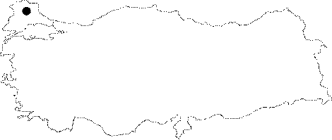
| Location: It lies on the shore of the Kiyiköy Village. It can be reached by the Kirklareli-Vize-Vizeköy motorway. |
| Structural Properties and formation : Located 2 m high from the sea level; it is a semi-active spring cave. It was formed as a result of corrosion by an underground creek reaching the shore and waves. Being 4-8 m wide and 0.5-6 m high; the transversal profile of the cave is zig zag depending on the extension and thickness of layers. With big blocks in the entrance zone; there are piles of pebbles and sand inside. The underground creek inflowing from the narrow fracture at the end brings in substantial amount of sand. |
| Research History: It was explored and mapped by MTA. |
| Findings: |