| ©The Archaeological Settlements of Turkey - TAY Project | ||||||
|
|
||||||
Karahöyük |
||||||
|
|
||||||
| Ages | Maps | Photos | ||||
| EBA IA |
 |
 |
||||
|
|
||||||
|
Type:
|
Mound | |||||
|
Altitude:
|
1200 m | |||||
|
Diameter:
|
m- Direction: | |||||
|
|
||||||
|
Region:
|
Eastern Anatolia | |||||
|
Province:
|
Kahramanmaras | |||||
|
District:
|
Elbistan | |||||
|
Village:
|
Karahüyük | |||||
|
|
||||||
|
Destruction :
|
Contemporary Settlements - Attention | |||||
|
|
||||||
|
TAYEx:
|
Visited - 8/8/2001 | |||||
|
|
||||||
|
Registration State:
|
Registered For detailed registration information please refer to Turkish pages. | |||||
 |
||||||
| Location: |
| Geography and Environment: |
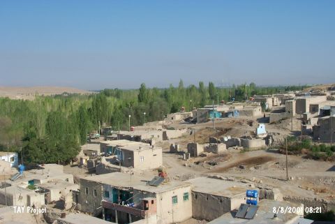
| Destruction Details: The mound has been damaged due to contemporary settlement and illicit diggings. There are lots of houses on all over the mound and big pits on southeastern slope. The huge pit on top hill which is locally called Nimet Deresi (Blessing Stream) [TAYEx 8.8.2001]. |