| ©The Archaeological Settlements of Turkey - TAY Project | ||||||
|
|
||||||
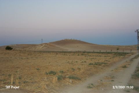
Girik Tepe |
||||||
|
|
||||||
| Ages | Maps | Photos | ||||
| Neolithic Chalcolithic |
 |
 |
||||
|
|
||||||
|
Type:
|
Mound | |||||
|
Altitude:
|
570 m | |||||
|
Diameter:
|
m- Direction: | |||||
|
|
||||||
|
Region:
|
Southeastern Anatolia | |||||
|
Province:
|
Adiyaman | |||||
|
District:
|
Merkez | |||||
|
Village:
|
Bebek | |||||
|
|
||||||
|
Destruction :
|
Agriculture | |||||
|
|
||||||
|
TAYEx:
|
Visited - 2/9/2001 | |||||
|
|
||||||
|
Registration State:
|
For detailed registration information please refer to Turkish pages. | |||||
 |
||||||
| Location: This site lies south of the city of Adiyaman; 7.6 km south of the town of Akpinar and 3.3 km southwest of the village of Bebek. |
| Geography and Environment: This site is northwest of Mount Karababa in the eastern part of a valley which reaches the Euphrates River Valley. The dimensions of the mound have not been reported. |
| Destruction Details: The north slope of the mound had been used for agricultural activities [TAYEx 2.9.2001]. |