| ©The Archaeological Settlements of Turkey - TAY Project | ||||||
|
|
||||||
Gelinciktepe |
||||||
|
|
||||||
| Ages | Maps | Photos | ||||
| EBA |
 |
 |
||||
|
|
||||||
|
Type:
|
Upland Settlement | |||||
|
Altitude:
|
845 m | |||||
|
Diameter:
|
m- Direction: | |||||
|
|
||||||
|
Region:
|
Eastern Anatolia | |||||
|
Province:
|
Malatya | |||||
|
District:
|
Merkez | |||||
|
Village:
|
Orduzu | |||||
|
|
||||||
|
|
||||||
|
|
||||||
|
TAYEx:
|
Visited - 21/7/2003 | |||||
|
|
||||||
|
Registration State:
|
For detailed registration information please refer to Turkish pages. | |||||
 |
||||||
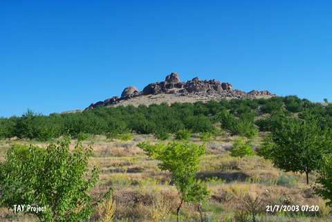
| Location: It stands on a rocky hill; about 2 km east (northeast) of Ordudüzü Sub-District and Arslantepe; northeast of the Malatya Province. The southern part of this hill called Gelinciktepe looks like a natural amphitheater named Markop. |
| Geography and Environment: The rock shelters and the spaces between the rocks on the southwestern slope of this rocky hill were occupied. Due to erosion; big rock blocks emerged on the top. The smaller pieces broken from the rocks are spread onto the slopes. The hill is in a position to be naturally defended. |
| Destruction Details: |