| ©The Archaeological Settlements of Turkey - TAY Project | ||||||
|
|
||||||
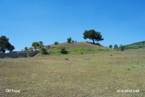
Evliya Tepesi |
||||||
|
|
||||||
| Ages | Maps | Photos | ||||
| Chalcolithic EBA |
 |
 |
||||
|
|
||||||
|
Type:
|
Mound | |||||
|
Altitude:
|
1290 m | |||||
|
Diameter:
|
62 m- Direction: WNW-ESE | |||||
|
|
||||||
|
Region:
|
Black Sea | |||||
|
Province:
|
Ordu | |||||
|
District:
|
Mesudiye | |||||
|
Village:
|
Erikköy | |||||
|
|
||||||
|
Destruction :
|
Contemporary Settlements | |||||
|
|
||||||
|
TAYEx:
|
Visited - 21/6/2003 | |||||
|
|
||||||
|
Registration State:
|
For detailed registration information please refer to Turkish pages. | |||||
 |
||||||
| Location: |
| Geography and Environment: |
| Destruction Details: The cemetery on the east-northeastern slope has damaged the site [TAYEx 21.6.2003]. |