| ©The Archaeological Settlements of Turkey - TAY Project | ||||||
|
|
||||||
Eskice Sirti |
||||||
|
|
||||||
| Ages | Maps | Photos | ||||
| Palaeolithic/Epipalaeolithic |
 |
 |
||||
|
|
||||||
|
Type:
|
Habitation Site / Workshop | |||||
|
Altitude:
|
10 m | |||||
|
Diameter:
|
m- Direction: | |||||
|
|
||||||
|
Region:
|
Marmara | |||||
|
Province:
|
Istanbul | |||||
|
District:
|
Büyükçekmece | |||||
|
Village:
|
||||||
|
|
||||||
|
Destruction :
|
Highways, roads, bridges etc. - Attention | |||||
|
|
||||||
|
TAYEx:
|
Visited - 25/11/2000 | |||||
|
|
||||||
|
Registration State:
|
For detailed registration information please refer to Turkish pages. | |||||
 |
||||||
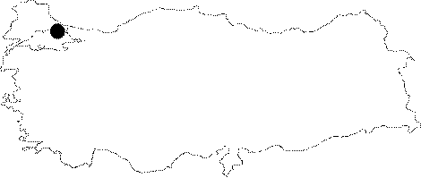
| Location: This site is northwest of Istanbul; north of the Büyükçekmece Lake and east of the Eskice Ridge immediately off the TEM; Istanbul-Edirne highway. Its code is D 11/ 11. |
| Geography and Environment: One of the high terraces of the Eskice Ridge was destroyed by the TEM highway construction. The site was destroyed in this process and the areas with artifacts scatters were covered by construction fill. |
| Destruction Details: |