| ©The Archaeological Settlements of Turkey - TAY Project | ||||||
|
|
||||||
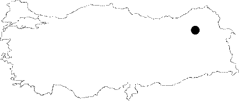
Erzurum - Hasankale |
||||||
|
|
||||||
| Ages | Maps | Photos | ||||
| Palaeolithic/Epipalaeolithic |
 |
 |
||||
|
|
||||||
|
Type:
|
Single Findspot | |||||
|
Altitude:
|
m | |||||
|
Diameter:
|
m- Direction: | |||||
|
|
||||||
|
Region:
|
Eastern Anatolia | |||||
|
Province:
|
Erzurum | |||||
|
District:
|
Pasinler | |||||
|
Village:
|
Yukariçakmak | |||||
|
|
||||||
|
|
||||||
|
|
||||||
|
TAYEx:
|
Not found - 28/6/2003 | |||||
|
|
||||||
|
Registration State:
|
For detailed registration information please refer to Turkish pages. | |||||
 |
||||||
| Location: This site is 20-25 km east of the city of Erzurum; in an old riverbed 300 m south of the Erzurum-Hasankale highway; northwest of the village of Yukari Çakmak. The stream which is now dry used to flow into the Posi Stream. |
| Geography and Environment: We lack geographical and geomorphic information on this site. |
| Destruction Details: |