| ©The Archaeological Settlements of Turkey - TAY Project | ||||||
|
|
||||||
Ergazi - Etimesgut |
||||||
|
|
||||||
| Ages | Maps | Photos | ||||
| Palaeolithic/Epipalaeolithic |
 |
 |
||||
|
|
||||||
|
Type:
|
Single Findspot | |||||
|
Altitude:
|
m | |||||
|
Diameter:
|
m- Direction: | |||||
|
|
||||||
|
Region:
|
Central Anatolia | |||||
|
Province:
|
Ankara | |||||
|
District:
|
Etimesgut | |||||
|
Village:
|
Ergazi | |||||
|
|
||||||
|
|
||||||
|
|
||||||
|
TAYEx:
|
Not visited - 10/7/2002 | |||||
|
|
||||||
|
Registration State:
|
For detailed registration information please refer to Turkish pages. | |||||
 |
||||||
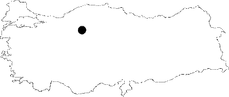
| Location: This site lies in the Etimesgut-Ankara Plain; west of Ankara. This plain is bounded by the village of Ergazi to the north; the village of Etimesgut/Etimesut to the west and the village of Güvercinli to the south. The sand quarries on the northern bank of the Ankara Stream; southeast of the village of Ergazi yielded Palaeolithic artifacts. Chipped stone tools were also found in the cross sections of three different gravelly sand quarries on the Ankara-Ayas highway heading west from Ankara at the 9th; 15th and 22nd kilometers. The tools; as a result; have been collected from a number of different unspecified sand quarries. It is not certain whether different researchers are referring to the same quarries. |
| Geography and Environment: Pfannenstiel; Kansu and Ozansoy who carried out geomorphological research in the Etimesgut Plain report that the plain has four terraces. The first terrace "T 1" includes the extensions of the plain which reach the city of Ankara and include the School of Agriculture (Yüksek Ziraat Enstitüsü) and the districts of Maltepe and Demirtepe. Terraces "T 2" and "T 3" include the village of Ergazi and its vicinity while the gravel and sand quarries west of the plain are on terrace "T 4". The stratigraphy of the sand and gravel filled depressions which are especially rich in Palaeolithic artifacts is not to be trusted because these depressions formed when parts of the plain sank and cleaved [Müller-Beck1960:116-117]. |
| Destruction Details: |