| ©The Archaeological Settlements of Turkey - TAY Project | ||||||
|
|
||||||
Dülük |
||||||
|
|
||||||
| Ages | Maps | Photos | ||||
| Palaeolithic/Epipalaeolithic |
 |
 |
||||
|
|
||||||
|
Type:
|
Habitation Site / Workshop | |||||
|
Altitude:
|
915 m | |||||
|
Diameter:
|
m- Direction: | |||||
|
|
||||||
|
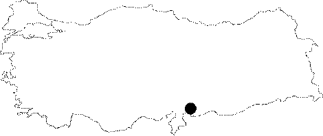
Region:
|
Southeastern Anatolia | |||||
|
Province:
|
Gaziantep | |||||
|
District:
|
Merkez | |||||
|
Village:
|
Dülük | |||||
|
|
||||||
|
|
||||||
|
|
||||||
|
TAYEx:
|
Visited - 21/8/2001 | |||||
|
|
||||||
|
Registration State:
|
Registered For detailed registration information please refer to Turkish pages. | |||||
 |
||||||
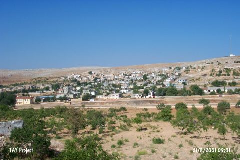
| Location: This site is around the village of Dülük; 11 km north of the city of Gaziantep; by the Dülük train station; in the vineyards on either side of the valley where the railroad tracks lie. |
| Geography and Environment: There are many rocky outcrops north; west and east of the village. The eastern part of the village is flat with the exception of the hill with rock-shelters at its base. The limestone is suitable for natural cave and rock-shelter formation. Bostanci surveyed the Zeyveli; Övelek; Kozluk stepped caves which are in and around the village houses; the entrance of the Kanli Cave; the village of Soguk and its vicinity and the district of Incirlik. Some of the natural limestone caves in the village are used as storage areas; barns and homes. The terraces at the outskirts of the village have been eroding since the Tertiary Period exposing wide areas with many flint nodules with calcareous deposits. These resources are among the reasons that attracted Palaeolithic hunter and gatherers to this area. Because of the high ironoxide mineral deposits; the soil in these terraces is a yellowish brick color. This mineral has given the chipped stone tools and nodules a bricky; yellowish patina. Many flint nodules; chipped stone tools and debitage products continue to be exposed as the fields and vineyards are plowed. |
| Destruction Details: |