| ©The Archaeological Settlements of Turkey - TAY Project | ||||||
|
|
||||||
Dudullu |
||||||
|
|
||||||
| Ages | Maps | Photos | ||||
| Neolithic |
 |
 |
||||
|
|
||||||
|
Type:
|
Artifact Scatter | |||||
|
Altitude:
|
200 m | |||||
|
Diameter:
|
m- Direction: | |||||
|
|
||||||
|
Region:
|
Marmara | |||||
|
Province:
|
Istanbul | |||||
|
District:
|
Ümraniye | |||||
|
Village:
|
Dudullu | |||||
|
|
||||||
|
Destruction :
|
Contemporary Settlements - Attention | |||||
|
|
||||||
|
TAYEx:
|
Not visited - 24/11/2000 | |||||
|
|
||||||
|
Registration State:
|
For detailed registration information please refer to Turkish pages. | |||||
 |
||||||
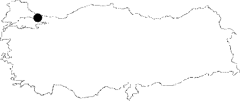
| Location: This site lies east of the old city of Istanbul; on the Asian side; by Dudullu; a village; now a suburb of Istanbul. This scatter of artifacts is on the ridge 250 m west of Asagi (lower) Dudullu. Because the ridge has no name; the site has been called Dudullu after the closest village. |
| Geography and Environment: No geological information has been provided on the ridge; now completely disturbed by modern development. The Dudullu Ridge is comprised of a few low and rolling hills. It is suspected that the climate in the past was different than today. |
| Destruction Details: |