| ©The Archaeological Settlements of Turkey - TAY Project | ||||||
|
|
||||||
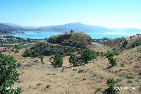
Dizik Höyük |
||||||
|
|
||||||
| Ages | Maps | Photos | ||||
| EBA |
 |
 |
||||
|
|
||||||
|
Type:
|
Mound | |||||
|
Altitude:
|
1305 m | |||||
|
Diameter:
|
m- Direction: | |||||
|
|
||||||
|
Region:
|
Eastern Anatolia | |||||
|
Province:
|
Elazig | |||||
|
District:
|
Maden | |||||
|
Village:
|
Gezin | |||||
|
|
||||||
|
Destruction :
|
Illicit Digging - Contemporary Settlements - Attention | |||||
|
|
||||||
|
TAYEx:
|
Visited - 15/7/2003 | |||||
|
|
||||||
|
Registration State:
|
Registered For detailed registration information please refer to Turkish pages. | |||||
 |
||||||
| Location: |
| Geography and Environment: |
| Destruction Details: The mound has been destructed by illicit diggings and removal of soil. Large amount of soil has been taken from all of the skirts and high sections formed at northwest and west slopes. There are two pits on the mound; one of them is at the north part of the mound measuring 10 m in diameter and the other is rectangular and locates on the northeast part [TAYEx 15.7.2003]. |