| ©The Archaeological Settlements of Turkey - TAY Project | ||||||
|
|
||||||
Dineksaray |
||||||
|
|
||||||
| Ages | Maps | Photos | ||||
| EBA IA |
 |
 |
||||
|
|
||||||
|
Type:
|
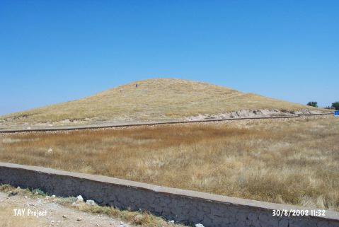
Mound | |||||
|
Altitude:
|
1040 m | |||||
|
Diameter:
|
300 m- Direction: SSW-NNE | |||||
|
|
||||||
|
Region:
|
Central Anatolia | |||||
|
Province:
|
Karaman | |||||
|
District:
|
Merkez | |||||
|
Village:
|
Dinek | |||||
|
|
||||||
|
Destruction :
|
Contemporary Settlements | |||||
|
|
||||||
|
TAYEx:
|
Visited - 30/8/2002 | |||||
|
|
||||||
|
Registration State:
|
For detailed registration information please refer to Turkish pages. | |||||
 |
||||||
| Location: |
| Geography and Environment: |
| Destruction Details: Soil has been taken from southwest skirt of the mound and southern skirt has been cut for road. There is a water reservoir on top hill and a road coming up from eastern slope. There are houses on northeast skirt [TAYEx 30.8.2002]. |