| ©The Archaeological Settlements of Turkey - TAY Project | ||||||
|
|
||||||
Demirtas Mevkii |
||||||
|
|
||||||
| Ages | Maps | Photos | ||||
| Palaeolithic/Epipalaeolithic |
 |
 |
||||
|
|
||||||
|
Type:
|
Single Findspot | |||||
|
Altitude:
|
270 m | |||||
|
Diameter:
|
m- Direction: | |||||
|
|
||||||
|
Region:
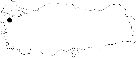
|
Marmara | |||||
|
Province:
|
Balikesir | |||||
|
District:
|
Ivrindi | |||||
|
Village:
|
Merkez | |||||
|
|
||||||
|
Destruction :
|
Agriculture - Highways, roads, bridges etc. | |||||
|
|
||||||
|
TAYEx:
|
Visited - 25/6/2000 | |||||
|
|
||||||
|
Registration State:
|
For detailed registration information please refer to Turkish pages. | |||||
 |
||||||
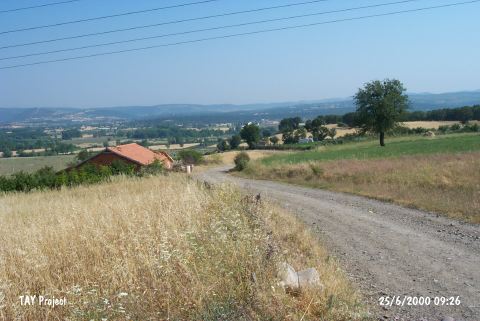
| Location: This site is southwest of the city of Balikesir; in the mountainous northern part of the Çetmialan Plain; 3 km northwest of the town of Ivrindi. |
| Geography and Environment: Several low lying mountains oriented northeast-southwest border the Çetmialan Plain. The Mandira Stream along with many other water sources hydrate this plain. |
| Destruction Details: The northern section of the settlement is planted and it is cut by a road [TAYEx 25.6.2000]. |