| ©The Archaeological Settlements of Turkey - TAY Project | ||||||
|
|
||||||
Assos |
||||||
|
|
||||||
| Ages | Maps | Photos | ||||
| IA |
 |
 |
||||
|
|
||||||
|
Type:
|
City | |||||
|
Altitude:
|
m | |||||
|
Diameter:
|
m- Direction: | |||||
|
|
||||||
|
Region:
|
Marmara | |||||
|
Province:
|
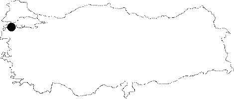
Çanakkale | |||||
|
District:
|
Ayvacik | |||||
|
Village:
|
Behram | |||||
|
|
||||||
|
|
||||||
|
|
||||||
|
TAYEx:
|
- | |||||
|
|
||||||
|
Registration State:
|
For detailed registration information please refer to Turkish pages. | |||||
 |
||||||
| Location: It is located in the Behram Village, southwest of the Ayvacik District in Çanakkale. |
| Geography and Environment: Situated accross the northern tip of the Lesbos (Midilli) Island on the southern shore of Troad, Assos is separated from the island with a strait, which is not over 11 m in width [Magie 2003:60]. |
| Destruction Details: |