| ©The Archaeological Settlements of Turkey - TAY Project | ||||||
|
|
||||||
Perinthos |
||||||
|
|
||||||
| Ages | Maps | Photos | ||||
| IA |
 |
 |
||||
|
|
||||||
|
Type:
|
City | |||||
|
Altitude:
|
m | |||||
|
Diameter:
|
m- Direction: | |||||
|
|
||||||
|
Region:
|
Marmara | |||||
|
Province:
|
Tekirdag | |||||
|
District:
|
Marmara Ereglisi | |||||
|
Village:
|
Merkez | |||||
|
|
||||||
|
|
||||||
|
|
||||||
|
TAYEx:
|
- | |||||
|
|
||||||
|
Registration State:
|
For detailed registration information please refer to Turkish pages. | |||||
 |
||||||
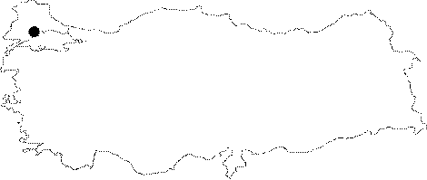
| Location: It is the modern Marmara Ereglisi District, 80 km west of Istanbul, 50 km east of Tekirdag on the northern shore of the Marmara Sea. It is known that it was founded as a colonial city in ca. 600 BC by the colonialists from Samos, and it was mentioned both by Herodotus [IV, 90; V, 1, 2; VI, 33; VII, 25] and Xenophon [Anabasis, VII, 2, 8; VII, 2, 10]. |
| Geography and Environment: It has two natural harbors. |
| Destruction Details: |