| ©The Archaeological Settlements of Turkey - TAY Project | ||||||
|
|
||||||
Panionion |
||||||
|
|
||||||
| Ages | Maps | Photos | ||||
| IA |
 |
 |
||||
|
|
||||||
|
Type:
|
Sanctuary | |||||
|
Altitude:
|
m | |||||
|
Diameter:
|
m- Direction: | |||||
|
|
||||||
|
Region:
|
Aegean | |||||
|
Province:
|
Aydin | |||||
|
District:
|
Söke | |||||
|
Village:
|
Davutlar | |||||
|
|
||||||
|
|
||||||
|
|
||||||
|
TAYEx:
|
- | |||||
|
|
||||||
|
Registration State:
|
For detailed registration information please refer to Turkish pages. | |||||
 |
||||||
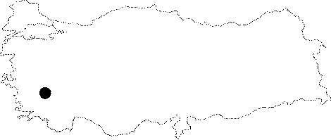
| Location: Panionion is situated 15 km north of the ancient city of Priene near the Mount Mykale on the Dilek Peninsula. It is within the borders of the Davutlar Town of the Söke District in Aydin. |
| Geography and Environment: According to Herodotus, Mykale is a promotory of the mainland extending to the west towards Samos; and Panionion is located on the northern section of this promontory. Strabo says that Panionion is three stadia from the sea, and it is the land of Pan-Ionia. And, surveys conducted by German archaeologists showed that Panionion was founded on the highest hills, which are approximately 750 m high, on the Mount Mykale. |
| Destruction Details: |