| ©The Archaeological Settlements of Turkey - TAY Project | ||||||
|
|
||||||
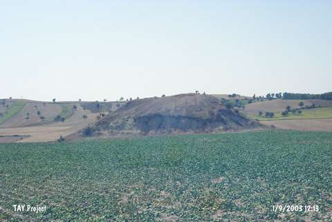
Çes Tepesi |
||||||
|
|
||||||
| Ages | Maps | Photos | ||||
| EBA IA |
 |
 |
||||
|
|
||||||
|
Type:
|
Slope Settlement | |||||
|
Altitude:
|
860 m | |||||
|
Diameter:
|
m- Direction: | |||||
|
|
||||||
|
Region:
|
Black Sea | |||||
|
Province:
|
Samsun | |||||
|
District:
|
Havza | |||||
|
Village:
|
Kuskonagi | |||||
|
|
||||||
|
Destruction :
|
Illicit Digging - Agriculture - Attention | |||||
|
|
||||||
|
TAYEx:
|
Visited - 1/9/2003 | |||||
|
|
||||||
|
Registration State:
|
For detailed registration information please refer to Turkish pages. | |||||
 |
||||||
| Location: |
| Geography and Environment: |
| Destruction Details: The north-northeastern slope of the settlement was cut to make way for fields. Traces of illicit diggings were observed on the southwestern part [TAYEx 1.9.2003]. |