| ©The Archaeological Settlements of Turkey - TAY Project | ||||||
|
|
||||||
Çeltikli |
||||||
|
|
||||||
| Ages | Maps | Photos | ||||
| Chalcolithic |
 |
 |
||||
|
|
||||||
|
Type:
|
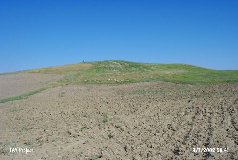
Mound | |||||
|
Altitude:
|
1140 m | |||||
|
Diameter:
|
140 m- Direction: NNE-SSW | |||||
|
|
||||||
|
Region:
|
Central Anatolia | |||||
|
Province:
|
Ankara | |||||
|
District:
|
Haymana | |||||
|
Village:
|
Çeltikli | |||||
|
|
||||||
|
Destruction :
|
Illicit Digging - Agriculture | |||||
|
|
||||||
|
TAYEx:
|
Visited - 3/7/2002 | |||||
|
|
||||||
|
Registration State:
|
For detailed registration information please refer to Turkish pages. | |||||
 |
||||||
| Location: |
| Geography and Environment: |
| Destruction Details: The mound is being damaged by illicit diggings and agricultural activities. It is planted and there is an illicit digging pit on its south-southeast part [TAYEx 3.7.2002]. |