| ©The Archaeological Settlements of Turkey - TAY Project | ||||||
|
|
||||||
Karatepe |
||||||
|
|
||||||
| Ages | Maps | Photos | ||||
| IA |
 |
 |
||||
|
|
||||||
|
Type:
|
Mound | |||||
|
Altitude:
|
m | |||||
|
Diameter:
|
m- Direction: | |||||
|
|
||||||
|
Region:
|
Mediterranean | |||||
|
Province:
|
Osmaniye | |||||
|
District:
|
Kadirli | |||||
|
Village:
|
Karatepe | |||||
|
|
||||||
|
|
||||||
|
|
||||||
|
TAYEx:
|
- | |||||
|
|
||||||
|
Registration State:
|
For detailed registration information please refer to Turkish pages. | |||||
 |
||||||
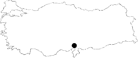
| Location: Karatepe-Arslantas is located within the borders of the Kadirli District in Osmaniye. It lies 20 km far from the district. The fortress is situated approximately 70 km northeast of the ancient city of Mopsuhestia (Misis/Yakapinar), probably once a major settlement in the region. |
| Geography and Environment: It is a natural hill on the west bank of the Ceyhan River, with a height of 22 m. Being one of the two fortified sites, which were strategically significant, rising on both banks of the Ceyhan River at the skirts of the Taurus Mountains delimiting the Cilician Plain, Karatepe commands the Ceyhan River on one side, the Andirin Plain on the north, and the ancient caravan road called "Akyol" running from Cilicia passing over the Taurus Mountains, and still used by the villagers and the yörüks (nomads) on the west. |
| Destruction Details: |