| ©The Archaeological Settlements of Turkey - TAY Project | ||||||
|
|
||||||
Karabur Rölyefleri |
||||||
|
|
||||||
| Ages | Maps | Photos | ||||
| IA |
 |
 |
||||
|
|
||||||
|
Type:
|
Single Findspot | |||||
|
Altitude:
|
m | |||||
|
Diameter:
|
m- Direction: | |||||
|
|
||||||
|
Region:
|
Mediterranean | |||||
|
Province:
|
Hatay | |||||
|
District:
|
Senköy | |||||
|
Village:
|
Çatbasi | |||||
|
|
||||||
|
|
||||||
|
|
||||||
|
TAYEx:
|
- | |||||
|
|
||||||
|
Registration State:
|
For detailed registration information please refer to Turkish pages. | |||||
 |
||||||
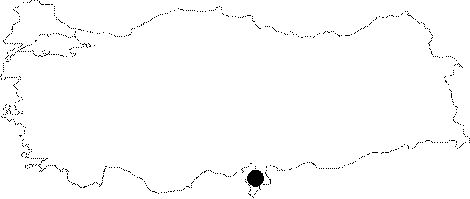
| Location: The reliefs were found in an area locally known as "Karabur" or "Siara", 1 km west of Çatbasi (Karsabul-Karsabay) in the Senköy region, some 25 km southeast of Antakya. |
| Geography and Environment: |
| Destruction Details: |