| ©The Archaeological Settlements of Turkey - TAY Project | ||||||
|
|
||||||
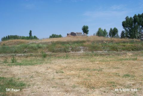
Çayirlik |
||||||
|
|
||||||
| Ages | Maps | Photos | ||||
| Chalcolithic IA |
 |
 |
||||
|
|
||||||
|
Type:
|
Mound | |||||
|
Altitude:
|
1270 m | |||||
|
Diameter:
|
55 m- Direction: SW-NE | |||||
|
|
||||||
|
Region:
|
Central Anatolia | |||||
|
Province:
|
Yozgat | |||||
|
District:
|
Bogazliyan | |||||
|
Village:
|
Çakmak | |||||
|
|
||||||
|
Destruction :
|
Agriculture - Contemporary Settlements | |||||
|
|
||||||
|
TAYEx:
|
Visited - 22/7/2002 | |||||
|
|
||||||
|
Registration State:
|
For detailed registration information please refer to Turkish pages. | |||||
 |
||||||
| Location: |
| Geography and Environment: |
| Destruction Details: The mound has been damaged due to agricultural activities and contemporary settlement. Skirts of the mound are cut and there is a ruined mudbrick house on top hill [TAYEx 22.7.2002]. |