| ©The Archaeological Settlements of Turkey - TAY Project | ||||||
|
|
||||||
Hamamtepe |
||||||
|
|
||||||
| Ages | Maps | Photos | ||||
| IA |
 |
 |
||||
|
|
||||||
|
Type:
|
Tumulus | |||||
|
Altitude:
|
m | |||||
|
Diameter:
|
m- Direction: | |||||
|
|
||||||
|
Region:
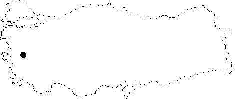
|
Aegean | |||||
|
Province:
|
Manisa | |||||
|
District:
|
Merkez | |||||
|
Village:
|
Kayapinar | |||||
|
|
||||||
|
|
||||||
|
|
||||||
|
TAYEx:
|
- | |||||
|
|
||||||
|
Registration State:
|
For detailed registration information please refer to Turkish pages. | |||||
 |
||||||
| Location: It is situated in Kayapinar Village west of Manisa. It is between the Organized Industrial Zone and the village, approximately 1 km southeast of the village. |
| Geography and Environment: The tumulus which is on the north slope of a natural hill on a mountaineous land overlooks Gediz (Hermos) Plain, has a 100 m diameter and 15 m height. |
| Destruction Details: |