| ©The Archaeological Settlements of Turkey - TAY Project | ||||||
|
|
||||||
Çatal Höyük |
||||||
|
|
||||||
| Ages | Maps | Photos | ||||
| Neolithic EBA |
 |
 |
||||
|
|
||||||
|
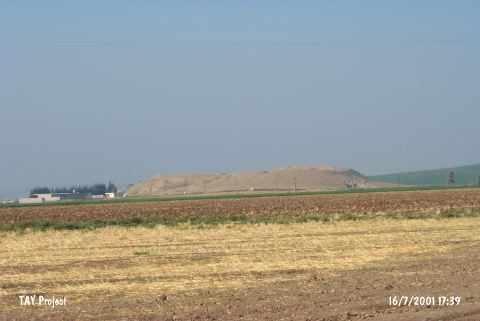
Type:
|
Mound | |||||
|
Altitude:
|
200 m | |||||
|
Diameter:
|
m- Direction: | |||||
|
|
||||||
|
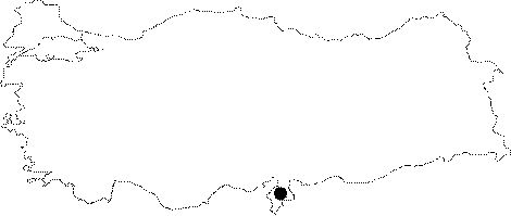
Region:
|
Mediterranean | |||||
|
Province:
|
Hatay | |||||
|
District:
|
Reyhanli | |||||
|
Village:
|
Çatalhöyük | |||||
|
|
||||||
|
Destruction :
|
Agriculture - Attention | |||||
|
|
||||||
|
TAYEx:
|
Visited - 16/7/2001 | |||||
|
|
||||||
|
Registration State:
|
Registered For detailed registration information please refer to Turkish pages. | |||||
 |
||||||
| Location: It lies on the east of the Reyhanli-Kirikhan motorway; 4 km northwest of the Reyhanli District; northeast of the Antakya Province. The motorway runs by the mound; therefore; it is easily accessible. |
| Geography and Environment: It is located on the southern bank of the Afrin Stream. It is reported to measure 430x265 m in dimensions according to the distribution of the pottery. It is ca. 25 m high above the plain level. It has an oval shape. |
| Destruction Details: The mound has been damaged due to agricultural activities and illicit diggings. Soil was removed from its western slope and surroundings are terraced. The channel excavated in 2 m width and 1 m depth went down from top hill to eastern skirt [TAYEx 16.7.2001]. |