| ©The Archaeological Settlements of Turkey - TAY Project | ||||||
|
|
||||||
Çaltidere |
||||||
|
|
||||||
| Ages | Maps | Photos | ||||
| Neolithic Chalcolithic EBA |
 |
 |
||||
|
|
||||||
|
Type:
|
Mound | |||||
|
Altitude:
|
0 m | |||||
|
Diameter:
|
m- Direction: | |||||
|
|
||||||
|
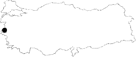
Region:
|
Aegean | |||||
|
Province:
|
Izmir | |||||
|
District:
|
Aliaga | |||||
|
Village:
|
Çaltilidere | |||||
|
|
||||||
|
Destruction :
|
Illicit Digging - Agriculture | |||||
|
|
||||||
|
TAYEx:
|
Visited - 17/9/2000 | |||||
|
|
||||||
|
Registration State:
|
Registered For detailed registration information please refer to Turkish pages. | |||||
 |
||||||
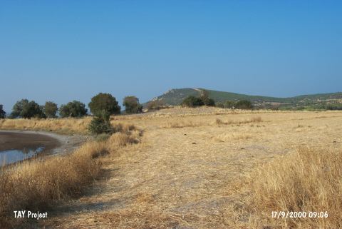
| Location: |
| Geography and Environment: |
| Destruction Details: The settlement is being damaged due to agricultural activities. A pit of illicit diggers was observed on the western section [TAYEx 17.9.2000]. |