| ©The Archaeological Settlements of Turkey - TAY Project | ||||||
|
|
||||||
Coskuntepe |
||||||
|
|
||||||
| Ages | Maps | Photos | ||||
| Neolithic |
 |
 |
||||
|
|
||||||
|
Type:
|
Flat Settlement | |||||
|
Altitude:
|
110 m | |||||
|
Diameter:
|
m- Direction: | |||||
|
|
||||||
|
Region:
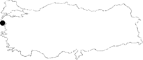
|
Marmara | |||||
|
Province:
|
Çanakkale | |||||
|
District:
|
Ayvacik | |||||
|
Village:
|
Bademli | |||||
|
|
||||||
|
Destruction :
|
Other - Natural causes - Attention | |||||
|
|
||||||
|
TAYEx:
|
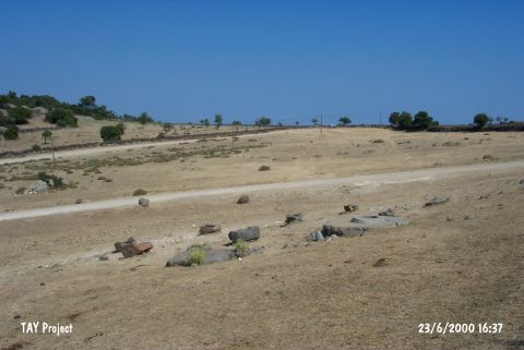
Visited - 23/6/2000 | |||||
|
|
||||||
|
Registration State:
|
For detailed registration information please refer to Turkish pages. | |||||
 |
||||||
| Location: This site is located south of the city of Çanakkale; south-southeast of the town of Gülpinar; 4 km southwest of the village of Bademli. It is possible to reach the site via the village road from Çanakkale to Bademli via Gülpinar. |
| Geography and Environment: The site is located on a rocky outcrop that faces the Island of Midilli in the Aegean Sea and is approximately 100 m above sea-level. Neither the extent of the surface pottery and thus the site-size nor the thickness of the cultural deposit has been determined. The cultural deposit does not appear to be very thick. There are historic ruins on top of the outcrop. Perhaps the reason why this site was settled throughout antiquity is the presence of a nearby prominent water source. The mountainous Biga Peninsula steeply ends when it meets the Aegean Sea. The surrounding soil is not very fertile. The settlement at this site may have been a fishing village. |
| Destruction Details: A road passes over the settlement [TAYEx 23.6.2004]. |