| ©The Archaeological Settlements of Turkey - TAY Project | ||||||
|
|
||||||
Büyüktepe |
||||||
|
|
||||||
| Ages | Maps | Photos | ||||
| Neolithic |
 |
 |
||||
|
|
||||||
|
Type:
|
Mound | |||||
|
Altitude:
|
200 m | |||||
|
Diameter:
|
m- Direction: | |||||
|
|
||||||
|
Region:
|
Mediterranean | |||||
|
Province:
|
Hatay | |||||
|
District:
|
Kumlu | |||||
|
Village:
|
Karahöyük | |||||
|
|
||||||
|
Destruction :
|
Contemporary Settlements - Attention | |||||
|
|
||||||
|
TAYEx:
|
Visited - 17/7/2001 | |||||
|
|
||||||
|
Registration State:
|
For detailed registration information please refer to Turkish pages. | |||||
 |
||||||
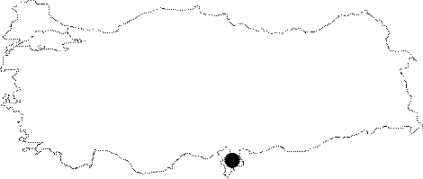
| Location: It lies at the northern entrance of Karahöyük Village; 4.2 km south of Kumlu District of Hatay Province. |
| Geography and Environment: This mound-site lies on the northern bank of Afrin Stream; approximately 300 m from the stream itself. This stream springs from Syria (Nahr Al Afrin) and empties into Lake Antioch (Amik Lake). It is reported that there was a swamp on one side of the mound when the area was surveyed in 1936 and that the soil east of the mound was very fertile. The swamps have now dried up. Low mounds like Büyüktepe on the Amuq Plain are now being plowed and slowly becoming destroyed. The inhabitants of this mound must have supplied their water from Afrin Stream. |
| Destruction Details: There is a gendarme station on top of the mound; it is almost vanished [TAYEx 17.7.2001]. |