| ©The Archaeological Settlements of Turkey - TAY Project | ||||||
|
|
||||||
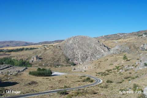
Büyükkaya |
||||||
|
|
||||||
| Ages | Maps | Photos | ||||
| Chalcolithic |
 |
 |
||||
|
|
||||||
|
Type:
|
Upland Settlement | |||||
|
Altitude:
|
1095 m | |||||
|
Diameter:
|
m- Direction: | |||||
|
|
||||||
|
Region:
|
Central Anatolia | |||||
|
Province:
|
Çorum | |||||
|
District:
|
Sungurlu | |||||
|
Village:
|
Bogazkale | |||||
|
|
||||||
|
|
||||||
|
|
||||||
|
TAYEx:
|
Not visited - 21/7/2002 | |||||
|
|
||||||
|
Registration State:
|
For detailed registration information please refer to Turkish pages. | |||||
 |
||||||
| Location: The site lies southwest of the city of Çorum; in the borders of Bogazköy southeast of Sungurlu; 600 m east of the village. |
| Geography and Environment: There are wavy plains and high elevations between them at the area where Bogazköy ruins are located. Büyükkaya is one of these elevations. |
| Destruction Details: |