| ©The Archaeological Settlements of Turkey - TAY Project | ||||||
|
|
||||||
Agin Deresi |
||||||
|
|
||||||
| Ages | Maps | Photos | ||||
| Palaeolithic/Epipalaeolithic |
 |
 |
||||
|
|
||||||
|
Type:
|
Habitation Site / Workshop | |||||
|
Altitude:
|
m | |||||
|
Diameter:
|
m- Direction: | |||||
|
|
||||||
|
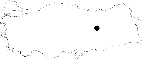
Region:
|
Eastern Anatolia | |||||
|
Province:
|
Elazig | |||||
|
District:
|
Agin | |||||
|
Village:
|
Merkez | |||||
|
|
||||||
|
Destruction :
|
Dams | |||||
|
|
||||||
|
TAYEx:
|
Not visited - 15/8/2003 | |||||
|
|
||||||
|
Registration State:
|
For detailed registration information please refer to Turkish pages. | |||||
 |
||||||
| Location: Before it was flooded by the Keban Dam Lake; this site was northwest of the city of Elazig; on the Agin Stream which flowed through the district of Agin. There are no records indicating which side of the stream the artifacts were collected from. |
| Geography and Environment: In his 1971 report written shortly after his survey of the site; I.K. Kökten indicated that the region was soon to be flooded. He also reported that there was a rock-shelter in the vicinity. The scale of the site is difficult to establish because no information on the extent of the site and the frequency of the artifacts has been provided. |
| Destruction Details: The mound is flooded by dam reservoir [TAYEx 15.8.2003]. |