| ©The Archaeological Settlements of Turkey - TAY Project | ||||||
|
|
||||||
Büyükbüziya Tepesi |
||||||
|
|
||||||
| Ages | Maps | Photos | ||||
| Palaeolithic/Epipalaeolithic |
 |
 |
||||
|
|
||||||
|
Type:
|
Habitation Site / Workshop | |||||
|
Altitude:
|
760 m | |||||
|
Diameter:
|
m- Direction: | |||||
|
|
||||||
|
Region:
|
Southeastern Anatolia | |||||
|
Province:
|
Batman | |||||
|
District:
|
Merkez | |||||
|
Village:
|
||||||
|
|
||||||
|
|
||||||
|
|
||||||
|
TAYEx:
|
Not visited - 16/9/2001 | |||||
|
|
||||||
|
Registration State:
|
For detailed registration information please refer to Turkish pages. | |||||
 |
||||||
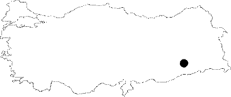
| Location: This site is located south-southeast of Batman; on the high ridge known as Büyükbüziya west of Mount Raman. This ridge appears on a 1:100;000 map. |
| Geography and Environment: It is believed that this habitation site is smaller than the site of Okçu. It will not be flooded by the dam-lake. |
| Destruction Details: |