| ©The Archaeological Settlements of Turkey - TAY Project | ||||||
|
|
||||||
Büyük Çekmece Yöresi |
||||||
|
|
||||||
| Ages | Maps | Photos | ||||
| Palaeolithic/Epipalaeolithic |
 |
 |
||||
|
|
||||||
|
Type:
|
Single Findspot | |||||
|
Altitude:
|
m | |||||
|
Diameter:
|
m- Direction: | |||||
|
|
||||||
|
Region:
|
Marmara | |||||
|
Province:
|
Istanbul | |||||
|
District:
|
Büyükçekmece | |||||
|
Village:
|
Ahmediye | |||||
|
|
||||||
|
|
||||||
|
|
||||||
|
TAYEx:
|
- | |||||
|
|
||||||
|
Registration State:
|
For detailed registration information please refer to Turkish pages. | |||||
 |
||||||
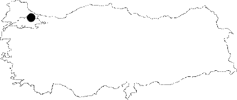
| Location: The Büyük Çekmece Yöresi Sites is the collective name for numerous open-air sites around the Büyük Çekmece Lake west of Istanbul. Artifacts were found in scatters in numerous lake-side villages such as Tepecik; Ahmediye; Bahsayis; Karaagaç and Çakmakli. One of the scatters included under this collective name is KUGUK DERE; located west of the lake and north of the village of Tepecik; on the northern shore of the Kuguk Dere Stream; close to the point where this stream empties into the lake. Another artifact scatter is found at KOLAGASI ÇIFTLIGI; north of the lake; immediately west of where the Karasu Stream empties into the lake. Also along this stream; south of the railroad tracks is the GAVURBAYIRI artifact scatter. Further south; by the TEM highway is yet another scatter of artifacts at ESKICE SIRTI (See Eskice Sirti in this volume). Furthermore; this collective site includes the KARAAGAÇ and SULTANCIFTLIGI artifact scatters; northeast of the village of Karaagaç and southeast of the lake respectively. And finally; south-southeast of Sultançiftligi; east of the lake is the AKÇABURGAZ artifact scatter. |
| Geography and Environment: The Karasu Stream north of the lake flows in a wide valley through the undulating terrain around the Büyük Çekmece Lake before it empties into it. Surveys for prehistoric sites in this region should be conducted on the ridges above the valleys. Since the construction of the TEM highway; these archaeological sites have been threatened by continually expanding modern settlement. |
| Destruction Details: |