| ©The Archaeological Settlements of Turkey - TAY Project | ||||||
|
|
||||||
Bozan |
||||||
|
|
||||||
| Ages | Maps | Photos | ||||
| Chalcolithic EBA Greek-Roman |
 |
 |
||||
|
|
||||||
|
Type:
|
Mound | |||||
|
Altitude:
|
820 m | |||||
|
Diameter:
|
m- Direction: | |||||
|
|
||||||
|
Region:
|
Aegean | |||||
|
Province:
|
Afyonkarahisar | |||||
|
District:
|
Dazkiri | |||||
|
Village:
|
Bozan | |||||
|
|
||||||
|
Destruction :
|
Other - Agriculture - Contemporary Settlements - Highways, roads, bridges etc. - Attention | |||||
|
|
||||||
|
TAYEx:
|
Visited - 4/10/2000 | |||||
|
|
||||||
|
Registration State:
|
Registered For detailed registration information please refer to Turkish pages. | |||||
 |
||||||
| Location: |
| Geography and Environment: |
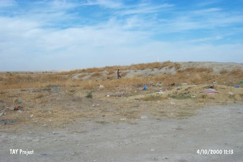
| Destruction Details: The depressed area in the middle section of the mound is being used as a garbage dump. The northeastern section was cut for agricultural purposes. The mound has lost its shape as a result of these severe destruction [TAYEx 4.10.2000]. It is damaged by floods [Koçak et al. 2017:239]. |