| ©The Archaeological Settlements of Turkey - TAY Project | ||||||
|
|
||||||
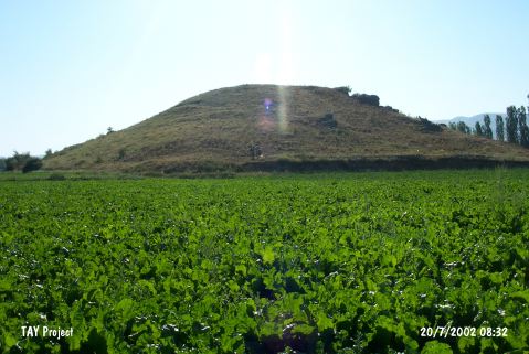
Boyali Höyük |
||||||
|
|
||||||
| Ages | Maps | Photos | ||||
| EBA |
 |
 |
||||
|
|
||||||
|
Type:
|
Slope Settlement | |||||
|
Altitude:
|
780 m | |||||
|
Diameter:
|
60 m- Direction: N-S | |||||
|
|
||||||
|
Region:
|
Central Anatolia | |||||
|
Province:
|
Çorum | |||||
|
District:
|
Sungurlu | |||||
|
Village:
|
Yörüklü | |||||
|
|
||||||
|
Destruction :
|
Agriculture | |||||
|
|
||||||
|
TAYEx:
|
Visited - 20/7/2002 | |||||
|
|
||||||
|
Registration State:
|
For detailed registration information please refer to Turkish pages. | |||||
 |
||||||
| Location: |
| Geography and Environment: |
| Destruction Details: The mound has been damaged due to agricultural activities. The western skirt has been cut in order to extend the planted areas and this caused a 1 m high section at the skirt [TAYEx 20.7.2002]. |