| ©The Archaeological Settlements of Turkey - TAY Project | ||||||
|
|
||||||
Aphrodisias - Pekmez |
||||||
|
|
||||||
| Ages | Maps | Photos | ||||
| Neolithic Chalcolithic EBA IA Greek-Roman 14C |
 |
 |
||||
|
|
||||||
|
Type:
|
Mound | |||||
|
Altitude:
|
500 m | |||||
|
Diameter:
|
m- Direction: | |||||
|
|
||||||
|
Region:
|
Aegean | |||||
|
Province:
|
Aydin | |||||
|
District:
|
Karacasu | |||||
|
Village:
|
Geyre | |||||
|
|
||||||
|
|
||||||
|
|
||||||
|
TAYEx:
|
Visited - 28/9/2000 | |||||
|
|
||||||
|
Registration State:
|
Registered For detailed registration information please refer to Turkish pages. | |||||
 |
||||||
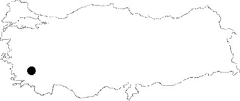
| Location: It lies about 13 km east of the Karasu District; east-southeast of the Aydin Province. The ancient city of Aphrodisias includes both Acropolis Tepesi (Höyük) and Pekmez Höyük and the settlement of Kuskalesi Mevkii dating from the EBA [Joukowsky 1986:19;482-483]. |
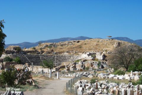
| Geography and Environment: The prehistoric settlements located in the ancient city date the history of this city back to the fifth and fourth millennia BC. The Geyre Stream; a branch of the Menderes River (the Meandros); irrigates the Geyre plains. The alluvium soil brought by this stream formed a fertile land around the settlements. The area is rich in water. Pekmez Höyük /Tepe; located on the south of Acropolis Tepe; measures 13 m in height and 125 m in diameter [Joukowsky 1986:19; 1989:225]. It was named by K. Erim. |
| Destruction Details: |