| ©The Archaeological Settlements of Turkey - TAY Project | ||||||
|
|
||||||
No Name (Kadinhani / Atlanti) |
||||||
|
|
||||||
| Ages | Maps | Photos | ||||
| Other/Unknown |
 |
 |
||||
|
|
||||||
|
Type:
|
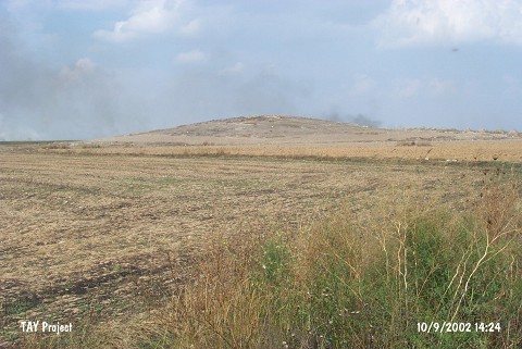
Mound | |||||
|
Altitude:
|
1030 m | |||||
|
Diameter:
|
150 m- Direction: SW-NE | |||||
|
|
||||||
|
Region:
|
Central Anatolia | |||||
|
Province:
|
Konya | |||||
|
District:
|
Kadinhani | |||||
|
Village:
|
Atlanti | |||||
|
|
||||||
|
Destruction :
|
Illicit Digging - Agriculture - Attention | |||||
|
|
||||||
|
TAYEx:
|
Visited - 10/9/2002 | |||||
|
|
||||||
|
Registration State:
|
For detailed registration information please refer to Turkish pages. | |||||
 |
||||||
| Location: |
| Geography and Environment: |
| Destruction Details: The mound has been damaged due to agricultural activities and illicit diggings. Skirts of the mound are completely planted and there are lots of pits on it. One of the pits measure 2 m in length and 7.5 m depth. The east-southeast skirt has been cut by a dirt road [TAYEx 10.9.2002]. |