| ©The Archaeological Settlements of Turkey - TAY Project | ||||||
|
|
||||||
Battal |
||||||
|
|
||||||
| Ages | Maps | Photos | ||||
| EBA |
 |
 |
||||
|
|
||||||
|
Type:
|
Mound | |||||
|
Altitude:
|
1065 m | |||||
|
Diameter:
|
125 m- Direction: W-E | |||||
|
|
||||||
|
Region:
|
Central Anatolia | |||||
|
Province:
|
Yozgat | |||||
|
District:
|
Merkez | |||||
|
Village:
|
Battal | |||||
|
|
||||||
|
Destruction :
|
Agriculture | |||||
|
|
||||||
|
TAYEx:
|
Visited - 21/7/2002 | |||||
|
|
||||||
|
Registration State:
|
Registered For detailed registration information please refer to Turkish pages. | |||||
 |
||||||
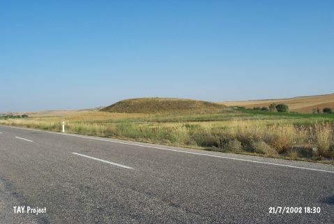
| Location: It lies east of the Battal Village in the valley of Konak Suyu; about 35 km southeast of the Yozgat Province. West of the mound Yozgat-Yenipazar motorway passes. |
| Geography and Environment: The mound is not very big in size. |
| Destruction Details: The mound is being damaged due to agricultural activities [TAYEx 21.7.2002]. |