| ©The Archaeological Settlements of Turkey - TAY Project | ||||||
|
|
||||||
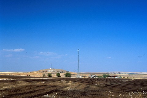
No Name (Siverek / Baslica) |
||||||
|
|
||||||
| Ages | Maps | Photos | ||||
| Other/Unknown |
 |
 |
||||
|
|
||||||
|
Type:
|
Mound | |||||
|
Altitude:
|
610 m | |||||
|
Diameter:
|
m- Direction: | |||||
|
|
||||||
|
Region:
|
Southeastern Anatolia | |||||
|
Province:
|
Sanliurfa | |||||
|
District:
|
Siverek | |||||
|
Village:
|
Baslica | |||||
|
|
||||||
|
Destruction :
|
Contemporary Settlements | |||||
|
|
||||||
|
TAYEx:
|
Visited - 4/9/2001 | |||||
|
|
||||||
|
Registration State:
|
For detailed registration information please refer to Turkish pages. | |||||
 |
||||||
| Location: |
| Geography and Environment: |
| Destruction Details: The mound is being destructed by contemporary settlement. There are houses on south slope and a telephone transmitter on top of the mound [TAYEx 4.9.2001]. |