| ©The Archaeological Settlements of Turkey - TAY Project | ||||||
|
|
||||||
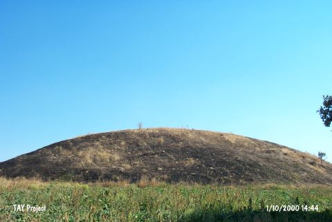
Banaz / Öksüz Höyük |
||||||
|
|
||||||
| Ages | Maps | Photos | ||||
| Other/Unknown |
 |
 |
||||
|
|
||||||
|
Type:
|
Mound | |||||
|
Altitude:
|
890 m | |||||
|
Diameter:
|
m- Direction: | |||||
|
|
||||||
|
Region:
|
Aegean | |||||
|
Province:
|
Usak | |||||
|
District:
|
Banaz | |||||
|
Village:
|
Öksüz | |||||
|
|
||||||
|
Destruction :
|
Illicit Digging - Agriculture | |||||
|
|
||||||
|
TAYEx:
|
Visited - 1/10/2000 | |||||
|
|
||||||
|
Registration State:
|
For detailed registration information please refer to Turkish pages. | |||||
 |
||||||
| Location: |
| Geography and Environment: |
| Destruction Details: The southwestern section of the mound is damaged due to cultivation. Illicit digging pits were observed on the northern and eastern skirts [TAYEx 1.10.2000]. |